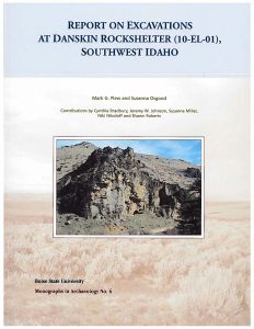
Report of Excavations at Danskin Rockshelter (10-EL-01), Southwest Idaho

Monographs in Archaeology, Volume No. 6
by Mark G. Plew and Susanna Osgood with contributions by Cynthia Bradbury, Jeremy W. Johnson, Susanne Miller, Niki Nikoloff, and Shawn Roberts
ISBN: 978-0-9779515-1-2 (2017)
169 pp.
Cost $20.00
Table of Contents
Introduction
Danskin Rockshelter is located on National Forest System lands managed by the United States Forest Service. The site, located on the South Fork Boise River, was first described by Erwin as part of his southwest Idaho inventory in 1929 (1930), and has remained of interest to archaeologists within the region since that time. Erwin was interested solely in the pictographs at what he referred to as Indian Point with no mention of the midden area associated with the rockshelter.
It is almost certain that Danskin had been repeatedly looted by the time Erwin visited the site. General Land Office records and maps identify Euromerican settlement in the area by the 1890s, and a local trail that was developed into a wagon road along the South Fork by the nineteen-teens. In 1906, a noncontiguous tract of land across the river from the rockshelter known as the “Danskin Division” was added to the Boise National Forest. By 1916, the Forest Service had built Danskin Ranger Station on the south side of the river across from Pierce Creek. Not until 1930, however, were the lands on the north side of the river, including Danskin Rockshelter, added to the National Forest System of lands. From 1933-1937, there was a Civilian Conservation Corps Camp (F-104) at the confluence of the river and Cow Creek, approximately three miles upstream from the rockshelter. The existing Danskin Bridge, built in 1957, replaced earlier structures built there by the CCC and before that, early settlers along the river.
Both the rockshelter’s proximity to the South Fork Boise River and its confluence with Pierce Creek less than a quarter mile downstream would have attracted visitors to the site (Figure 1). The rockshelter is clearly visible from the road and easy to access. At Pierce Creek, travelers either crossed Danskin Bridge to the ranger station and homesteaded further downstream, or made their way up the Pierce Creek Road to Smith Prairie. The confluence was a busy area and still is today. It is reasonable to assume that Danskin’s pictographs and the potential for “relics” encouraged digging.
In 1958, Donald Tuohy, a research associate with the Idaho State College (now University) Museum visited the rockshelter and noted that the deposits had been “churned by amateurs” (Tuohy and Swanson 1960). In 1972, Earl Swanson notified the Forest Service of Tuohy’s findings. Agency files from that time onward document numerous additional looting incidents that eventually culminated in the decision to excavate the site in cooperation with the Department of Anthropology, Boise State University. In 1989, test excavations were undertaken as part of a proposed multi-year interdisciplinary study of the environmental and archaeological history of the region. Danskin’s vulnerability to looting became evident when the site was vandalized during the excavation. Since 1989 there have been additional documented incidents.