Unmanned aerial vehicle (UAV)-based hyperspectral remote sensing capabilities developed by the Idaho National Lab and Idaho State University, Boise Center Aerospace Lab, were tested via demonstration flights that explored the influence of altitude on geometric error, image mosaicking, and dryland vegetation classification. The test flights successfully acquired usable flightline data capable of supporting classifiable composite images.
Unsupervised classification results support vegetation management objectives that rely on mapping shrub cover and distribution patterns.
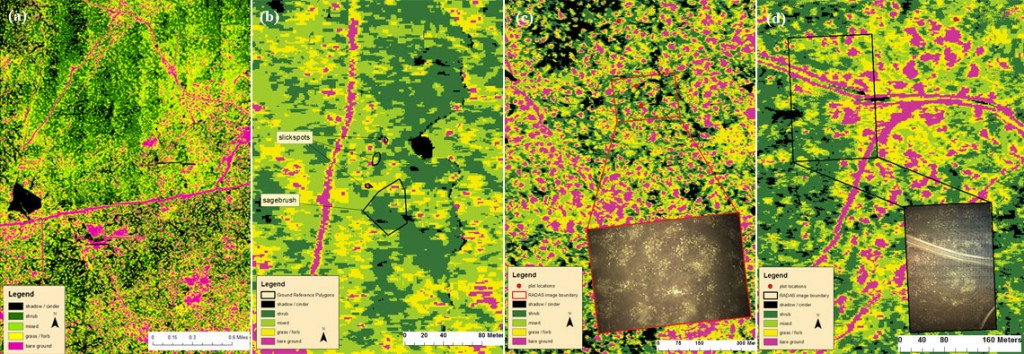
Future mapping efforts that leverage ground reference data, ultra-high spatial resolution photos
and time series analysis should be able to effectively distinguish native grasses such as Sandberg bluegrass (Poa secunda), from invasives such as burr buttercup (Ranunculus testiculatus).
For more information, please contact Nancy Glenn at (208) 373-1819 or bcal@isu.edu.
[notice title=”Related Publication” color=”grey”]J J Mitchell, N F Glenn, M O Anderson, R C Hruska, A Halford, C Baun, N Nydegger. 2012. Unmanned aerial vehicle (UAV) hyperspectral remote sensing for dryland vegetation monitoring. Idaho National Laboratory preprint.[/notice]