Working From What We Know to What We Don’t Know
Julio Gonzalez Tepetla, Dr. Pei-Lin Yu, Dr. Mark Plew, James Eschenbrenner, Jake Fruhlinger
Overview
- Predictive models help assess large areas remotely to prioritize, strategize, and allocate resources efficiently.
- Section 106 and 110 of the National Historic Preservation Act of 1966 provide the legal basis for federal protection of archaeological sites.
- We aim to utilize a predictive model to assist in land management and develop protective measures for cultural resources in the Orchard Combat Training Center (OCTC).
Background
Michael Bishop
- BSU Alumnus Michael Bishop developed the predictive model based specifically on the geospatial elements within the region.
- In 2015, Bishop applied the model to an area of 5,500 acres followed by pedestrian survey to test results.
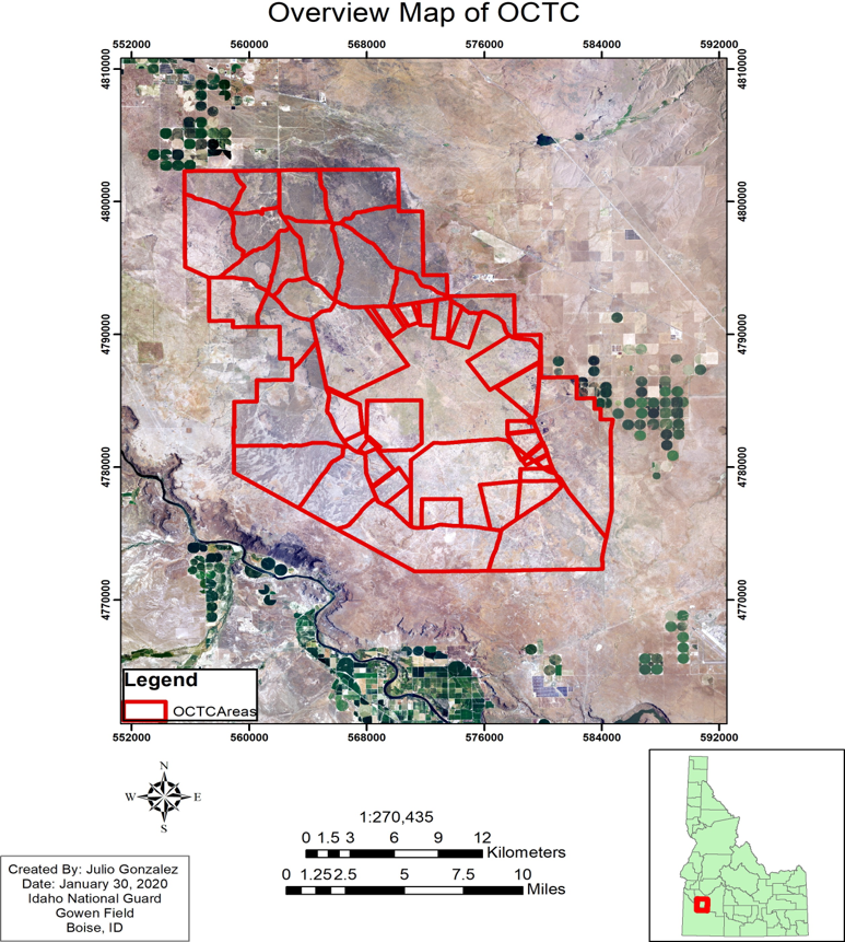
The Study Area: OCTC
- The OCTC is a military training center located within the Snake River Birds of Prey National Conservation Area in Southern Idaho.
- Part of the Snake River Plain and the Great Basin.
- Traditional territory of Shoshone, Bannock, and Paiute peoples.
- Idaho National Guard (IDNG) training grounds.
Objectives
- Main goal: Apply Bishop’s model to a 24,627-acre area neighboring the 2015 test area to produce a map identifying areas of high probability for encountering archaeological sites within a 30-meter buffer.
- Facilitate land management to help protect cultural resources in the OCTC, which are protected by law and important to descendant communities.
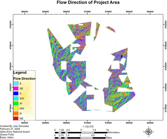
Methods
Using GIS software, LiDAR elevation data, and cultural point data from known sites, we created a Hydrology layer and Elevation layer in ArcMap to isolate the spots based on the statistically derived
parameters from Bishop’s model shown in Table 1.
Table 1. Statistically Derived Parameters in Meters
| Elevation | Distance to Hydrology | Angle to Hydrology |
|---|---|---|
| >949 and <961 >989 and <1000 >1009 and <1021 | <12 | <-90 and >90 |
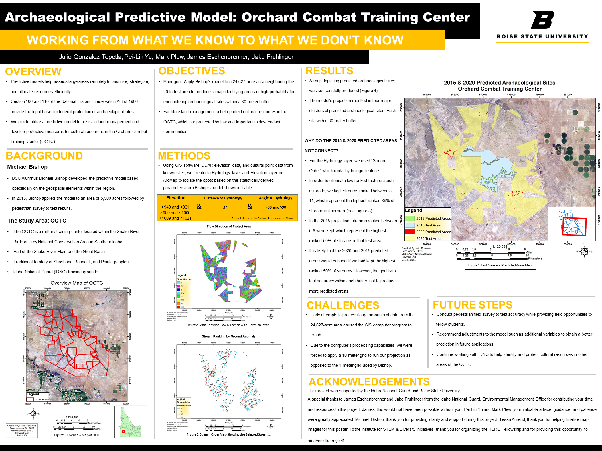
Results
- A map depicting predicted archaeological sites was successfully produced (Figure 4).
- The model’s projection resulted in four major clusters of predicted archaeological sites. Each site with a 30-meter buffer.
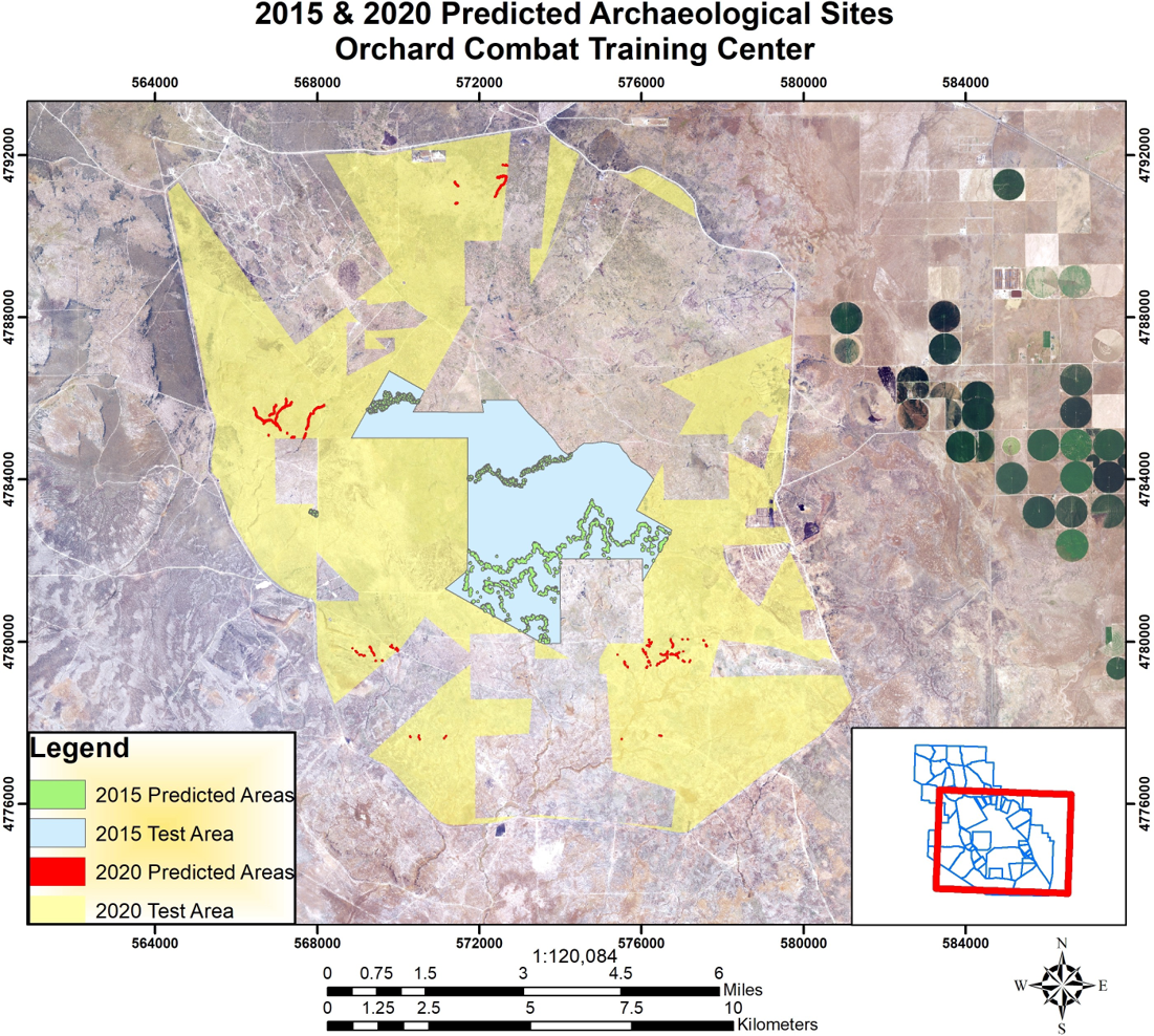
Why do the 2015 and 2020 predicted areas not connect?
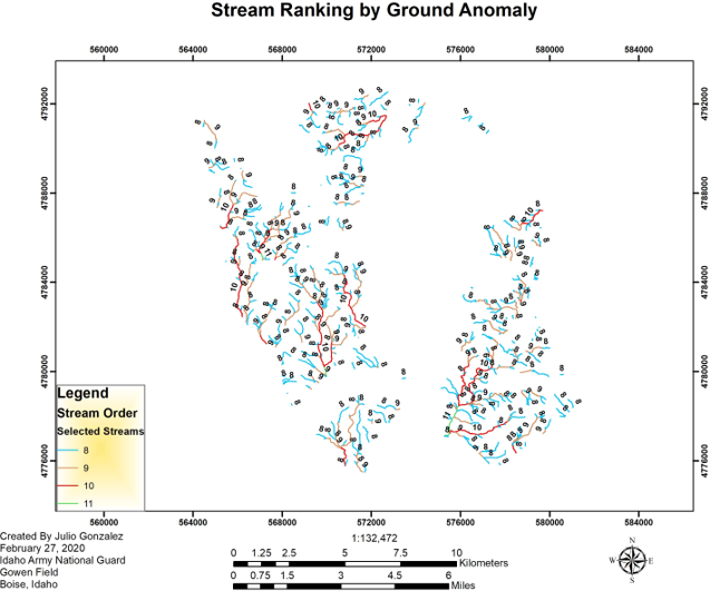
- For the Hydrology layer, we used “Stream Order” which ranks hydrologic features.
- In order to eliminate low ranked features such as roads, we kept streams ranked between 8-11, which represent the highest ranked 36% of streams in this area (see Figure 3).
- In the 2015 projection, streams ranked between 5-8 were kept which represent the highest ranked 50% of streams in that test area.
- It is likely that the 2020 and 2015 predicted areas would connect if we had kept the highest
ranked 50% of streams. However, the goal is to test accuracy within each buffer, not to produce
more predicted areas.
Challenges
- Early attempts to process large amounts of data from the 24,627-acre area caused the GIS computer program to crash.
- Due to the computer’s processing capabilities, we were forced to apply a 10-meter grid to run our projection as opposed to the 1-meter grid used by Bishop.
Future Steps
- Conduct pedestrian field survey to test accuracy while providing field opportunities to
fellow students. - Recommend adjustments to the model such as additional variables to obtain a better
prediction in future applications. - Continue working with IDNG to help identify and protect cultural resources in other
areas of the OCTC.
Acknowledgements
This project was supported by the Idaho National Guard and Boise State University.
A special thanks to James Eschenbrenner and Jake Fruhlinger from the Idaho National Guard, Environmental Management Office for contributing your time and resources to this project. James, this would not have been possible without you. Pei-Lin Yu and Mark Plew, your valuable advice, guidance, and patience were greatly appreciated. Michael Bishop, thank you for providing clarity and support during this project. Tessa Amend, thank you for helping finalize map images for this poster. To the Institute for STEM & Diversity Initiatives, thank you for organizing the HERC Fellowship and for providing this opportunity to students like myself.
Additional Information
For questions or comments about this research, contact at Julio Gonzalez Tepetla at juliogonzalez604@u.boisestate.edu.