Jerry C. Mock, Dr. Jacob Anderson, Dr. Jeffrey B. Johnson, Scott J. Gauvain
Background
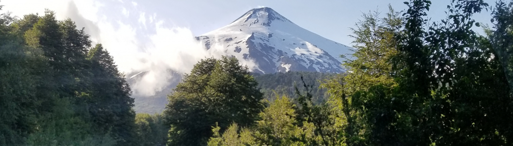
Infrasound is long wavelength sound, inaudible to humans, which is widely used in volcano monitoring. Infrasound radiation is directly correlated with physical processes occurring at a volcanic vent and may be used to determine volcanic activity levels. Volcán Villarrica, Chile, has an open vent and active lava lake, which is an excellent source of powerful and continuous infrasound. One of the research goals of our January 2020 expedition to Villarrica was to determine the influence of intervening topography on the amplitude and spectral content of infrasound data recorded far from the vent (~12 km).
Methods
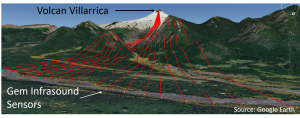 Infrasound data was collected from Volcán Villarrica in Chile by setting up a linear Gem sensor array, with the line normal and equidistant to the source (Volcán Villarrica).
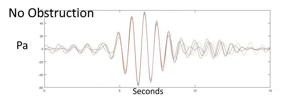
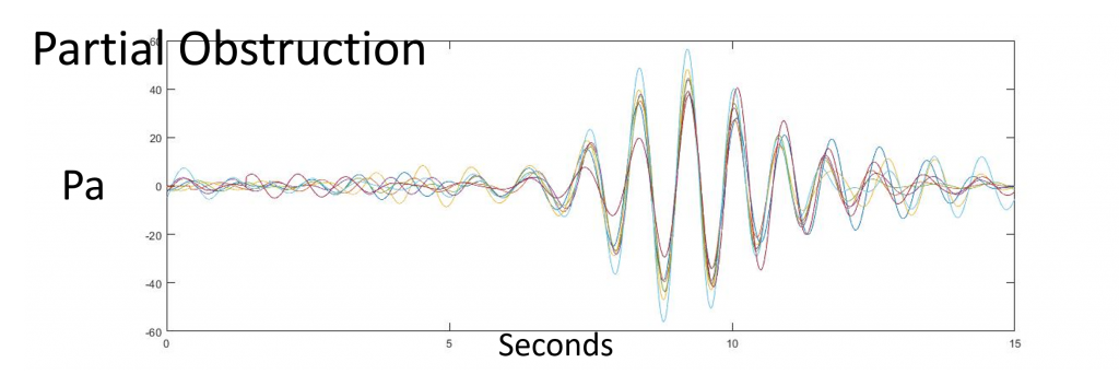
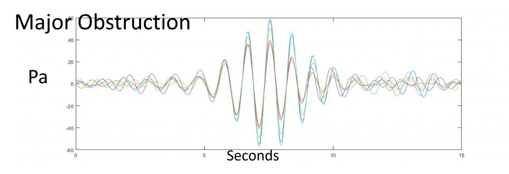
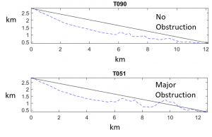 The topographic data was mapped using Google Earth and MATLAB, then the stations were split into 3 groups: No obstruction, Partial Obstruction, Major Obstruction.
- The infrasound data was processed in MATLAB to alleviate the noise using high and low pass digital filters and aligned peak to peak for comparison, removing distance as a noise factor.
- The waveforms of three groups were graphed in MATLAB and compared.
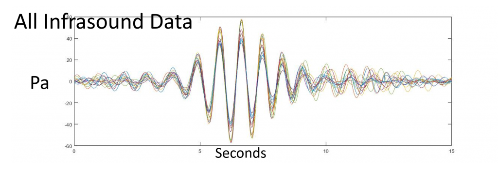
Initial Findings: Intervening topography does impact infrasonic wave propagation
All Infrasound Data
No Obstruction
Partial Obstruction
Major Obstruction
Equipment
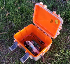
The Gem infrasound sensors are the product of years of effort by Dr. Jacob Anderson here at Boise State University. The Gems used on the January 2020 expedition to Villarrica were manufactured by every one of the authors in one capacity or another.
Conclusions
Initial findings show that topographic interference does impact infrasound wave propagation by direct visual comparison of the data.
Ongoing research will consist of running propagation models from the source and doing quantitative analysis on a supercomputer as well as doing comparison with the infrasound signal direct from the crater rim as a standard. Geophysicist Dr. Keehoon Kim has provided the code for propagation modeling that will be used in 2D and 3D comparisons.
Topographic interference research will inform on the placement of future monitoring stations and improve on the current infrasound model.
Additional Information
For questions or comments about this research, contact Jerry Mock at jerrymock@u.boisestate.edu.