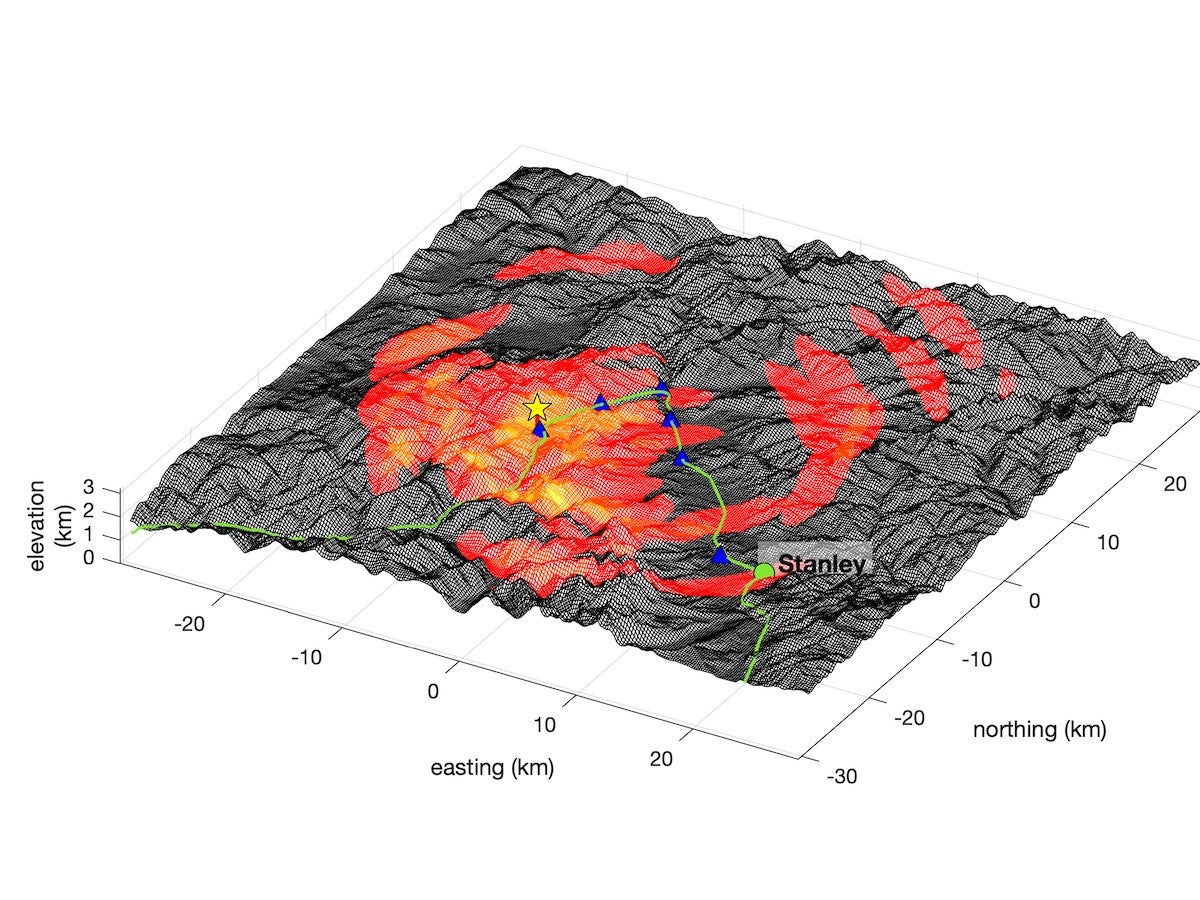
On March 31, 2020, the words ‘shake,’ ‘rattle’ and ‘roll’ took on a whole new meaning for Idaho residents as the state’s second largest recorded earthquake rumbled from its epicenter in the Challis National Forest. In the months following this rare 6.5 magnitude earthquake, more than 900 aftershocks with magnitudes over 1.5 have been detected.
Now with two grants – $73,000 from the National Science Foundation (NSF) and $49,000 from the United States Geological Survey (USGS) – a team of Boise State geosciences faculty are working to capture more information about this unusual earthquake and gain a deeper understanding of seismic activity in the state.
“The goal is that we create a new data set that the whole seismic and infrasound communities can use. We don’t have a lot of big earthquakes in this area very often, and we actually don’t know a lot about the seismicity and the tectonics in central Idaho. So by collecting this data set, we’re creating the potential to learn a lot more,” explained principal investigator Dylan Mikesell, an associate professor of geosciences.
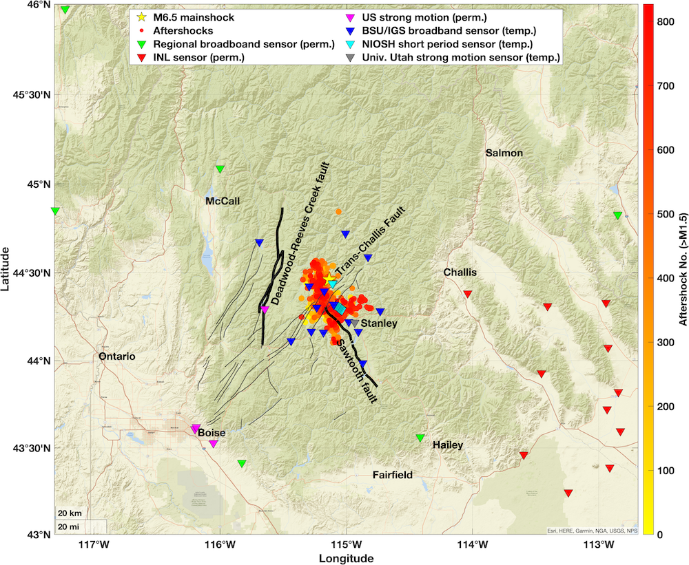
With fellow geosciences faculty, including principal investigator and research professor Lee Liberty, associate professors HP Marshall and Jeffrey Johnson, and research scientist Jake Anderson, Mikesell is heading into the mountains to place dozens of seismometers and infrasound sensors to collect real-time data.
Infrasound sensors are modified microphones that, unlike human ears, pick up on very low frequency pressure changes in the atmosphere: in this case, the rumbling of earthquakes.
“This earthquake activity in our ‘back yard’ permits us to study the details of earthquake physics, including how seismic waves shake the earth’s surface and radiate sound waves into the atmosphere,” said Johnson. “This work will hopefully allow us to understand how and why humans can actually hear some earthquakes, but not others.”
Mikesell explained that while there are frequent small earthquakes in Idaho, they don’t pose much threat because of the state’s low population density. However this low density is also why seismic sensors are scarce in Idaho, when compared to more populated states like Washington and California. As evidenced by the NSF and USGS grants, there is a push to rectify that and provide the state with more information about central Idaho’s recent seismic activity.
The research team not only will provide a more comprehensive understanding of Idaho earthquake activity, they also will have the chance to benefit the fields of acoustics and seismology as they test the capabilities and potential of their experimental sensing technology.
“The Stanley aftershock sequence is a perfect test for our experimental dense array. The array can identify sources of earthquake infrasound in detail, helping to answer the scientific question of what seismic and topographic conditions are needed to produce secondary earthquake infrasound,” said Anderson. “Further, the abundant aftershocks of varying magnitude provide a perfect dataset for answering the methodological question of assessing the array’s detection and resolution capabilities, helping to guide future projects recording volcanoes and avalanches.”
-By Brianne Phillips