Wildfires may feel like an increasingly common part of our lives, but what’s incredible is that every fire is unique. Where they burn, how long they last, how hot they get, what fuels they consume, which communities they touch – and how those communities, lands and ecosystems respond – are all different stories.
The truth is, wildfires are reshaping our lives in ways we don’t yet fully understand – and in many cases, there’s no existing research or guidebook to tell us how a burn site, and all who call it home, will be changed.
Fortunately, one thing never changes: the drive to conduct research, engage in field and lab work and fill the gaps in current knowledge to prepare the state of Idaho – and beyond – for the certainty of wildfire.
Wildfires in mountain ranges
One of Idaho’s most enduring natural treasures is its mountain ranges. However, these intensely beautiful geological wonders have a unique relationship with wildfire that is quickly evolving due to climate change. Year after year of record-breaking heat is fueling fires high in the alpine. A mountain range’s physical characteristics shape how fires burn, how firefighters are able to respond, how communities are impacted and how the earth reacts after the fire.
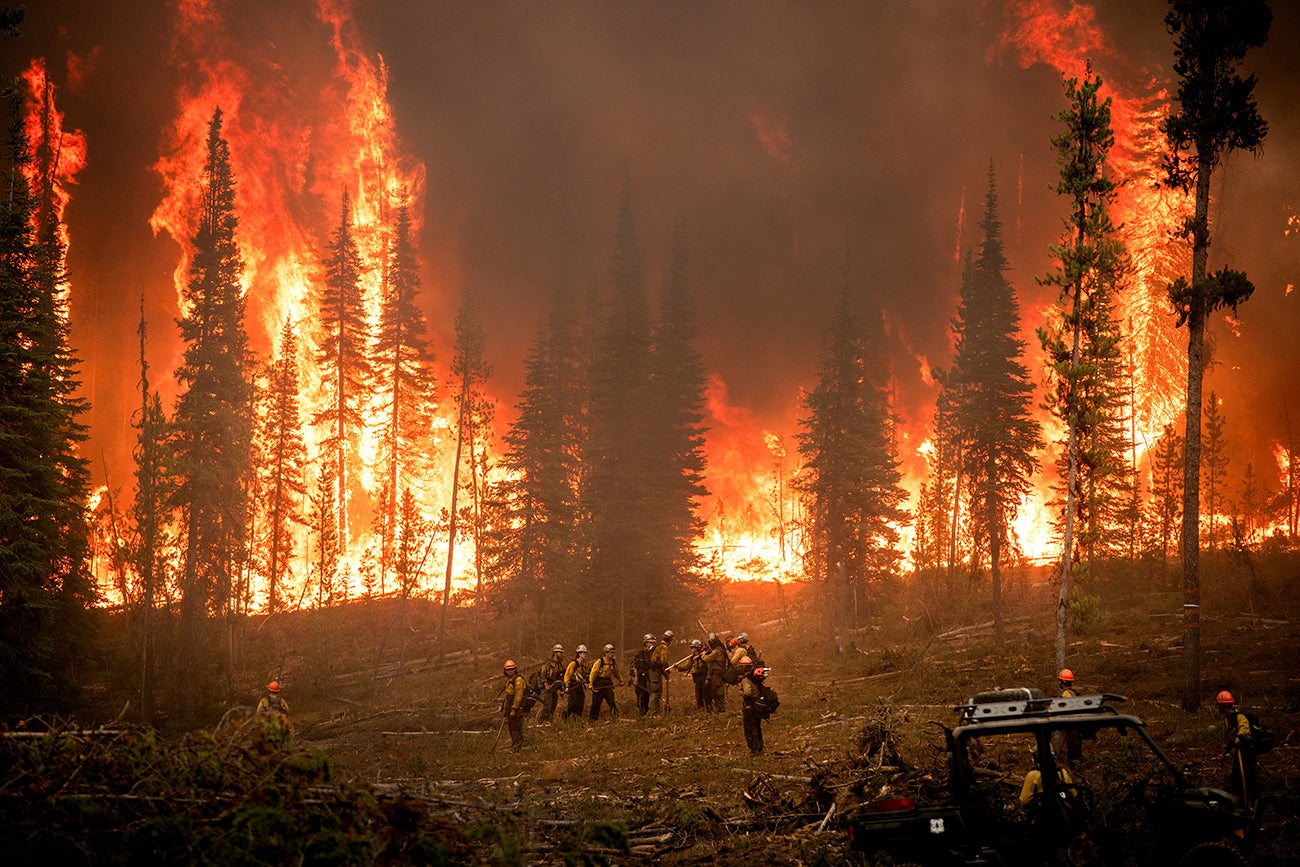
For example, on July 24, 2024 a crack of lightning lit a fire in the Sawtooth Mountains two miles southwest of Grandjean and 14 miles southwest of Stanley. This started the Wapiti Fire. Fueled by dry weather, steep terrain, limited firefighter access and abundant grasses, brush, and timber, the fire burned from July through November 2024, consuming nearly 130,000 acres.
This fire burned through forests that used to be too wet to burn. Boise State geoscience professor Jen Pierce researched her dissertation in this same area, reconstructing records of fire that span back 8,000 years. This research shows the last time these forests burned with anything approaching this severity was about 1000 years ago.
Wildfires followed by debris flows are a deadly one-two punch that plague mountainous areas and must be better understood in order to protect life, property and ecosystems. Debris flows are hazardous landslides of rock, mud, ash, tree limbs and other debris that according to the United States Geologic Survey can travel at speeds up to and exceeding 35 mph and travel for several miles. A heart-wrenching example is the 2018 Montecito debris flow in California that claimed 23 lives a month after a series of nearby wildfires.
For Boise State geoscience researchers Pierce, Anna Bergstrom, Josh Enterkine, Jake Anderson, School of Computing doctoral student Amirhossein (Amir) Montazeri and affiliate faculty member from the University of Texas at El Paso, David Huber, studying debris flows is an opportunity to advance science around post-wildfire ecosystems and protect communities in the face of the unknown.
Examining debris flows in Idaho
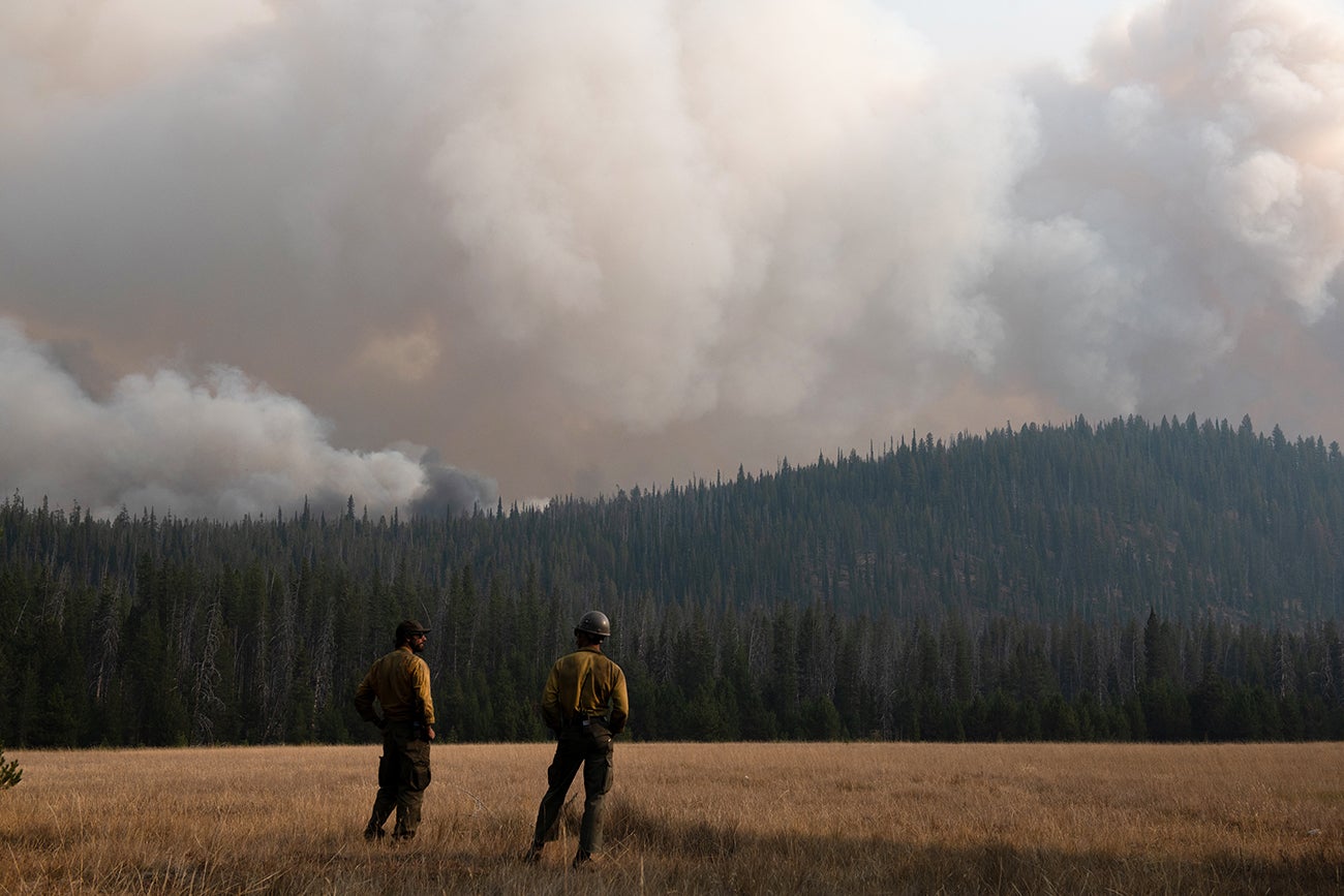
As soon as it was safe enough to access, the Boise State team set out into the Sawtooth Mountains. Some began placing sensors and cameras, while others gathered ash and water samples on foot. This data, in addition to satellite imagery, provides a partial image of vegetation and soil burn severity and makes it possible to predict debris flows and their possible impacts.
When wildfires burn, they release nutrients that were stored in plants. Nitrogen, phosphorus, carbon and mineral ash come to sit on top of hard, fire-baked, hydrophobic soils. When the rains and early mountain snows come, this can cause problems downstream.
“You’ve got all of these nutrients and a lot of them are ending up in the South Fork of the Payette [River],” Huber said. “All of a sudden you have a potential water quality issue, with the potential to impact those downstream ecosystems. The fish are going to be impacted, as are the aquatic insect microbial communities. These water quality issues are important to human health/drinking water, recreation, and sustaining our ecosystems; all impacted by fires.”
From a helicopter above, Enterkine collected lidar (light detection and ranging) data to quantify any of the changes to the landscape. By collecting pre-, during, and post-fire lidar data, Enterkine said the team will be able to “calculate the amount of earth removed from the upslope areas, how much has been deposited in the downslope areas, and the difference in material would approximate what entered the South Fork.”
The U.S. Army Corps of Engineers Cold Regions Research and Engineering Laboratory group lent their helicopter-based lidar scanner and assisted in its collection. Enterkine worked with the U.S. Forest Service and Federal Aviation Administration to secure special permission to fly in restricted airspace over the then-active fire perimeter. He then operated the lidar scanner during flights, collecting data over the key areas identified by the research team.
Modeling a better future for debris flow research
Across the world, researchers are conducting this same field research process as wildfires reshape their communities.
For Montazeri, a second-year doctoral data science student from Iran, experiencing this process first-hand informed his work in the computer lab. Montazeri is a Future Investigators in NASA Earth and Space Science and Technology award-winning student. He is building a machine-learning model that not only predicts wildfire impacts on soil and informs post-fire hazard mitigation but also answers fundamental scientific questions about the strength of control of various processes on soil burn severity outcomes.
Traversing the charred landscape of Idaho to gather samples and listening to the stories of those who lived through the wildfire left a deep impression on Montazeri, he said. It’s fueling his desire to revolutionize the process of creating soil burn severity maps both for researchers and the communities facing the very real danger of post-wildfire debris flows, erosion and water quality issues.
“I just wanted to know everything about it and observe what’s going on in a real situation to make better predictions with my models,” Montazeri said. “I knew that the fire was severe and it would affect the downstream systems, but I can’t believe how big it was. You talk to people living downstream, and after the rain destroyed roads and knocked out power… it all became tangible when I saw it.”
“Any opinions, findings and conclusions or recommendations expressed in this material are those of the author(s) and do not necessarily reflect the views of the U.S. National Science Foundation.”
By Brianne Phillips