Multi-offset radar data acquired over a conductive LNAPL plume at the Former Wurtsmith AFB, Michigan.
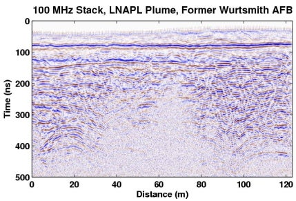
400 ft long 2D 100 MHz data acquired in common source point gathers with 1 ft receiver interval and 2 ft source interval. Additional acquisition details are found in the EBCDIC header. Data format: IBM floating point SEGY
Relevant References
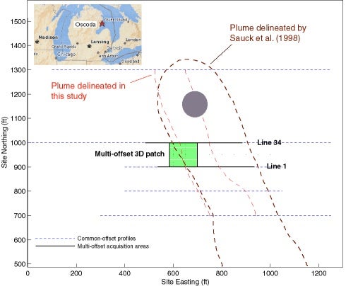
Bermejo, J.L., Sauck, W.A., and Atekwana, E.A., 1997, Geophysical discovery of a new LNAPL plume at the former Wurtsmith AFB, Oscoda, Michigan: Groundwater Monitoring and Remediation, 17, 131-137.
Bradford, J.H., 2003, GPR offset-dependent reflectivity analysis for characterization of a high-conductivity LNAPL plume: SAGEEP 2003 Symposium on the Application of Geophysics to Environmental and Engineering Problems, Environmental and Engineering Geophysical Society, 238-252.
Bradford, J.H., and Deeds, J.C., 2006, Ground-penetrating radar theory and application of thinbed offset dependent reflectivity: Geophysics, 71, K47-K57.
Sauck, W.A., Atekwana, E.A., and Nash, M.S., 1998, High conductivities associated with an LNAPL plume imaged by integrated geophysical techniques: Journal of Environmental and Engineering Geophysics, 2, 203-212.
Contact: johnb@cgiss.boisestate.edu