Research computing advances graduate-led terrestrial ecology study
Trailblazing research requires not only ambitious and creative minds, but also technological capabilities and support. Fortunately for Boise State researchers, the university’s Research Computing Support department is available to help with the pursuit of new breakthroughs. With the services the department provides, data processing that could take researchers days or even weeks to complete can be done in a matter of hours, and the department also can provide technical expertise and support to help researchers with wrangling their data.
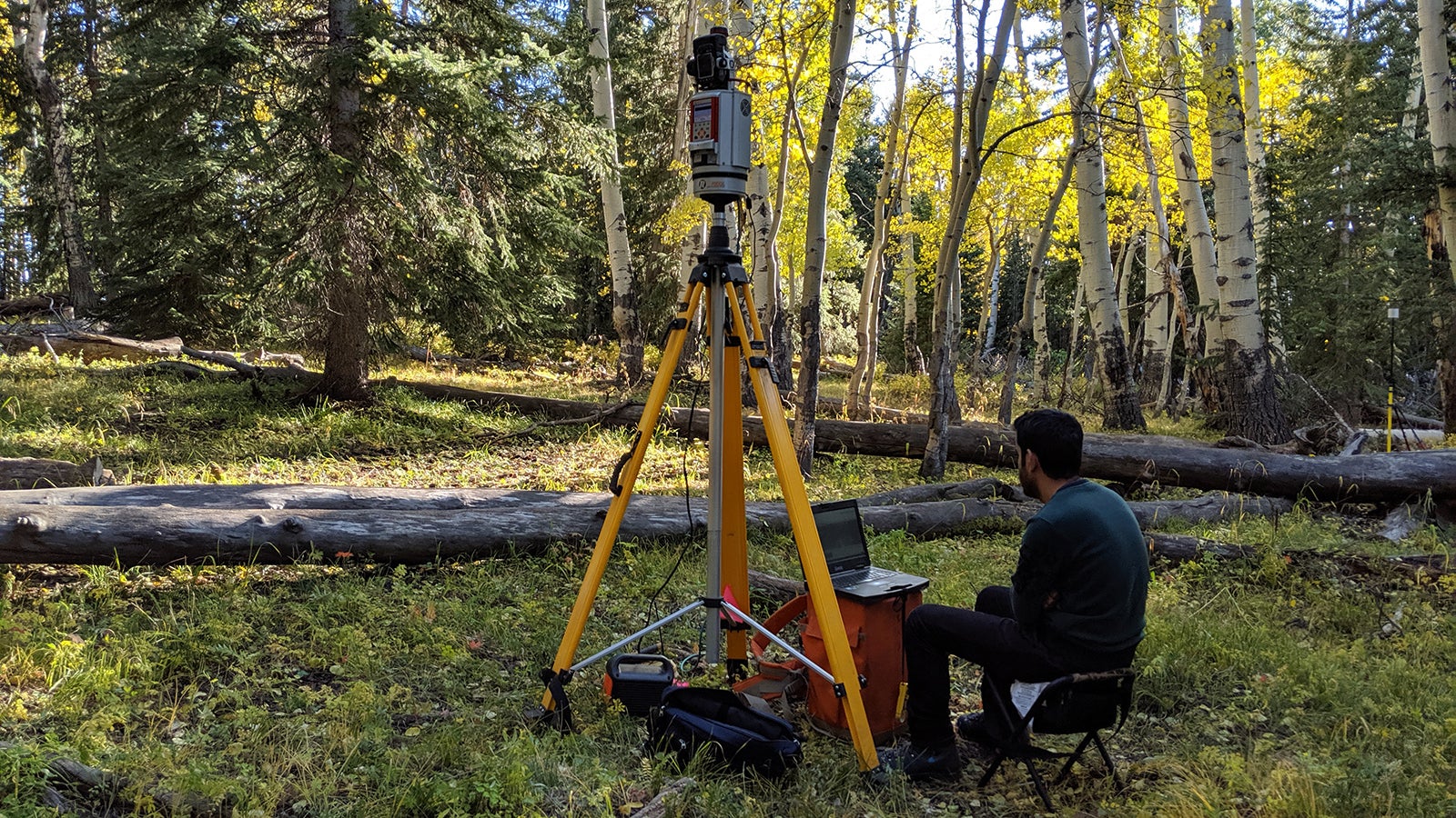
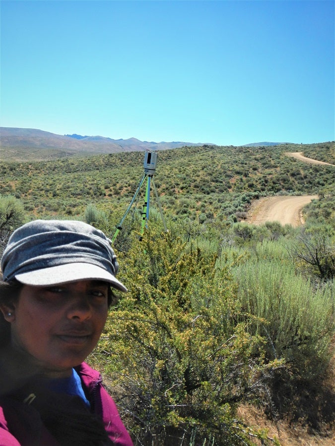
Take Nayani Ilangakoon for example. She’s a doctoral student in the geosciences department and the lead graduate student of a research group that uses remote sensing technology to measure changes in the drylands of Idaho and Colorado. With the help of team members Ahmad Hojjati, a doctoral student in the computing program, and Hamid Dashti, a geosciences doctoral student, Ilangakoon is monitoring the Reynolds Creek Experimental Watershed in Southwest Idaho, as well as areas in Grand Mesa, Colorado.
“Almost half of Earth’s terrestrial surface, including most of the Western U.S., is covered by drylands. These ecosystems are continuously changing due to fires, grazing and grass invasion, not to mention many other anthropocentric and climate-driven disturbances. We need ways to measure those changes so that we can take action,” explained Ilangakoon.
These projects are overseen by Dr. Nancy Glenn, a geosciences professor and the head of the Boise Center Aerospace Laboratory at Boise State. This lab documents Idaho’s changing landscapes and helps enable land managers to decide how best to preserve and restore the ecosystems.
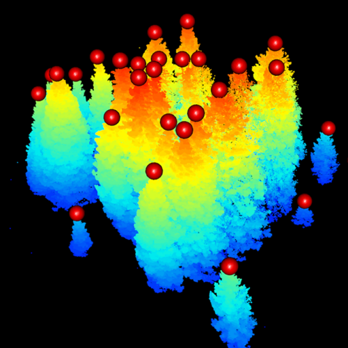
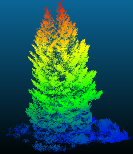
Photos and graphics provided by Boise Center Aerospace Laboratory
When Ilangakoon started her doctoral program in the lab, her team was using point data from a light detection and ranging system – otherwise known as lidar – on a NASA-funded terrestrial ecology project. Lidar measures the time it takes laser pulses shot from an airborne sensor to hit the target and then return to the sensor, which then generates a “squiggly line” of data for analysis.
However, there were two main barriers to the processing of full-waveform lidar data. The first was that processing lidar data takes a significant amount of computation. Ilangakoon was processing this on her laptop, where it took days to complete a single file. Seeing that this wasn’t tenable in the long run, she reached out to the department to get access to Boise State’s high performance computing (HPC) cluster, R2.
The R2 takes computing to a whole new level. To put the cluster’s computing power in perspective, the average person’s laptop has four CPU cores. A higher-end computer typically has eight or 16. The R2 cluster has 28 cores in each of its 41 compute nodes, for a total of 1,148 cores.
Kyle Shannon, a research computing department employee, assisted Ilangakoon by writing a program that could take the raw lidar data and convert it into a usable format so it could be analyzed on R2.
“They helped me get access to write bash scripts, transfer data and most importantly to use multiple nodes and many cores efficiently in R2. Things that took me days [on my desktop computer] could finish in half days or less,” Ilangakoon said.
The second issue was computer memory usage. The size of the lidar files limited Ilangakoon to processing 10 x 10 meter areas at a time, as processing larger areas took a prohibitively large amount of random-access memory (RAM) to do. For Ilangakoon’s data sets that covered enormous swaths of land, this proved to be a problem.
When faced with this issue of scaling up from small test areas to much larger landscapes, the team reached out to Dr. Cathie Olschanowsky, an assistant professor in the Department of Computer Science. Olschanowsky oversees a team in the Adapt Lab, which works to make applications run faster and with less memory overhead on HPC systems like R2.
Olschanowsky organized undergraduate computer science students who rewrote the software used in the lidar analysis with a performance-oriented approach. Through their collaborative efforts, the two labs are working to push the limits of processing Ilangakoon’s lidar datasets to 238 square kilometers, or 92 square miles, at a time.
Project draws NASA interest
As it scales, their work has exciting future applications. A team at NASA’s Goddard Space Flight Center is interested in implementing the Adapt Lab’s optimization solutions for use with their own data. Through this and other NASA projects that are interested in the collaboration, the team’s computing methods may one day be used to assess the whole globe.
In addition to assisting Ilangakoon, the Research Computing Support department has empowered Boise State research faculty and students in nearly every college with the technological expertise and equipment to conduct the ambitious research that will answer our world’s most pressing questions.
– By Forrest Burt