As the two foolish pigs learned before running to their brother’s solidly built house of bricks for safety, when the wolf comes calling, the quality of your shelter is everything. Animals in the wild have always instinctively known this. But changes to their habitat in the wake of human encroachment, climate change and a variety of environmental influences are affecting the predator-prey relationship and creating new “fearscapes” dotted with predation risks.
To better understand what’s happening, researchers are using innovative imaging techniques to map the properties of vegetation that influence how and when they are used for cover from the elements and from predators. Their data could help dictate land management decisions and restoration of the landscape.
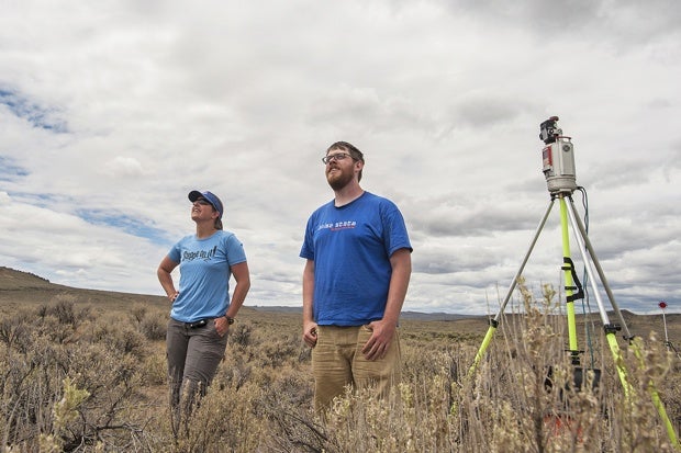
Backed by several National Science Foundation grants, with additional university funding, the project is led by Boise State University alumnus and current Washington State University graduate student Peter Olsoy, along with Boise State faculty Jennifer Forbey and Nancy Glenn and graduate student Jordan Nobler; Janet Rachlow from University of Idaho; and Lisa Shipley from Washington State. Their findings are published in BioScience, the journal of the American Institute of Biological Sciences: [bibliplug id=1282]
Mapping the functional elements of vegetation — those that provide concealment, for instance — purely from ground level can be tricky. Such measures are location specific and tend to provide limited data. So the team used ground measurements combined with terrestrial laser scanning to create a more richly detailed fearscape map.
Researchers used LiDAR to capture detailed images. Using remote sensing, LiDAR targets an object with a laser, and then analyzes the reflected light to capture an image of the object’s 3D structure. “It essentially creates a map showing relative risk for an animal based on how well it can be hidden,” Forbey said.
Using unmanned aerial vehicles, the team gathered data from multiple vantage points, representing predator sightlines as well as the visibility of potential predators by prey. Information gathered could help researchers understand how habitat changes can impact the predator-prey relationship.
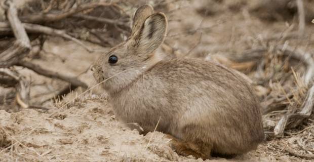
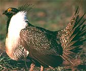
The report notes that many prey species in Idaho (such as pygmy rabbits and sage-grouse) rely on sagebrush vegetation for refuge from predators like badgers, coyotes and birds of prey. But the increase in invasive species is altering the landscape and affecting the ability of prey to find shelter.
Images captured by LiDAR are allowing researchers to compare the landscape from various eye-heights (coyote vs. weasel), positions (standing vs. lying) and modes of hunting (ground vs. air).
And once the data are collected, the images can be manipulated to reflect changes in the environment or vegetation structure. How does the area look in summer vs. the dead of winter, when leaves are gone and cover is scarce? How does a heavy snowstorm change things? What if conditions lead to slow or accelerated growth of plants?
“That’s the cool part of this,” Forbey said. “We collect the data once and we can manipulate it forever.”
Forbey said the project was conducted as a “proof of concept” model. Creating 3D images of habitats will allow for future research in the area of reproductive success of birds like sage-grouse that create visual displays to attract mates.
“We plan to use this technology to assess the most visible locations where male sage-grouse are likely to be seen by potential mates,” she said. “We’ll be able to assess the likelihood of mating success for males according to their location on the breeding ground.”
This material is based upon work supported by the National Science Foundation under grants No. DEB-1146194, DEB-1146368 264, DEB-1146166 and IOS-1258217. Any opinions, findings, and conclusions or recommendations expressed in this material are those of the authors and do not necessarily reflect the views of the National Science Foundation. The Terrestrial LiDAR was generously supported by Idaho National Laboratory; contact Randy Lee.
Watch a video about unmanned aerial vehicles
http://www.youtube.com/embed/_Nr5ezlfYM4
Source: BSU Update