

By Brandi Burns, Boise City Department of Arts and History
Brandi Burns’ mission is to make history alive and real for every person who lives in or visits the City of Boise. To engage the public and foster a love of history, Burns conceives and produces creative live tours and lectures (including the popular Fettuccine Forum), thought-provoking exhibits, virtual tours and educational experiences. Burns oversaw Boise’s designation as an Idaho Heritage City, one that encourages preservation and interpretation of its cultural heritage. In her role as History Programs Manager, Burns preserves and collects historic artifacts and manuscripts, conducts research, and analyzes and presents data—positioning her as resident expert on the city’s history. Burns served on the National Storytelling Network’s Brimstone Award Committee and was a two-time presenter at RootsTech, the largest genealogy conference in the world with 26,000 attendees. She serves as the northwest’s regional Chair for the American Association for State and Local History (AASLH), and holds a Masters of Applied Historical Research from Boise State, and a B.A. in History from Idaho State University.
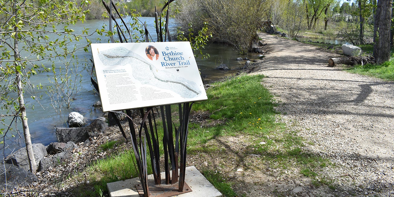
Boise is known as a top city in the nation for recreation opportunities. Anyone with a mind to enjoy the outdoors can do so, whether their activities range from hiking in the foothills, floating the Boise River, visiting one of the city’s many parks, or walking or biking on the Greenbelt. Boise defies the idea that an urban city is separate from the natural environment. What came first? A population that desires to be active or infrastructure that encourages activity? This sounds like a classic chicken or egg situation, but in the case of the Greenbelt, the answer seems to point to the idea that if the infrastructure is in place, people will use it. But how did we end up with a resource like the Greenbelt? To find that answer, we must examine Boiseans’ changing relationship with the Boise River, the city’s transformation into a modern city, and the vital contributions of civic groups.
Boise’s Back Door: The Boise River
Today, the Boise River is an amenity, but for many years it was used as a waste disposal system. Raw sewage from the city was piped directly into the river, and several slaughterhouses were located along its banks and washed the blood and offal directly into the river. This was not a unique situation; cities across the country located near a river used their rivers in the same way. The river was also viewed as destructive. Spring runoff would cause flooding in the city, inundating farms, businesses, and homes every year. Because of its shifting banks and the importance of having a reliable water source for irrigation, residents of the Boise Valley were very interested in controlling the river through dams. The dams followed one after the other in this order: Diversion Dam (1908), Arrowrock Dam (1915), Anderson Ranch Dam (1950), and Lucky Peak Dam (1955). The control over the river tightened, and with Lucky Peak’s completion, new recreational opportunities opened for residents, including tubing down the river during the summer months.
Before the 1950s, tubing along the Boise River was a rather unattractive prospect with raw sewage and industrial waste entering the river. This started to change after Boise City built its first wastewater treatment plant on Lander Street in 1949. A year after the plant began operations, a local paper ran a story that rainbow trout had returned to the Boise River. The wastewater treatment plant was followed by a city ordinance that banned dumping trash in unauthorized areas, including along the Boise River. These actions slowed the pollutants entering the river, which led to cleaner water and were pivotal steps for people to begin seeing the river as an asset and not a trash can.
Despite this, when the idea for the Greenbelt surfaced in the city’s first comprehensive plan (adopted 1964), the river edges were still full of trash. Car bodies lined the banks, poison oak was prolific, and property owners near the river even facilitated dumping trash along the banks. Councilman Bill Onweiler describes one such situation in an oral history: “All of the wire that had ever been accumulated and bands and junk and boxes, they would bring down Fletcher Street and put in his warehouse and then throw it out the back door. And I took my family down. I’d talk about this, and they were curious. So, we took box lunches, and we walked through this mess. I was afraid my kids weren’t going to make it. It was awful.” Exacerbating the problem was the issue that few people even knew about the Boise River. Onweiler, in his interview, said there were people at that time “who were unaware that there was much of a river through Boise. They just drove across the bridges.”
Prepping for the Boise River Greenbelt
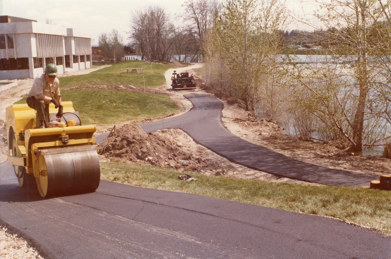
While this attitude prevailed, the City produced the first Greenbelt comprehensive plan in 1969. The initial vision in the plan was for a six-mile path that extended on both sides of the Boise River. The plan acknowledged the project would be expensive, both in initial acquisition and continued maintenance. Therefore, “it is highly desirable to encourage citizen organizations to participate in the development of the Greenbelt, and a coordinated effort to direct these energies would create the greatest benefit to the public.” To help meet this recommendation, the City created a Greenbelt and Pathways Committee in 1969.
This obliviousness changed after Bill Onweiler created a film in 1970 and brought it to various clubs and organizations in Boise to garner support for the Greenbelt. The video is on YouTube at 1970 Boise River Greenbelt aerial video narrated by Bill Onweiler. Onweiler described the video in a letter to his children that “It wasn’t much of a production, but it sold more people than any local promo I’d ever seen. The people in Boise had never viewed their river from this angle. In fact, most never saw where the river flowed within the city.” The video truly was a success; Onweiler took the video to club after club in Boise with fellow councilman Sherm Perry. A typical club meeting involved comments from Perry on Boise and then he would ask Onweiler to say a few comments and show the film. Onweiler said “the question period told us what a success the program had been. I recall being as much as a half hour late leaving a meeting…The most frequent comment was… ‘How do we get it done?’ A fellow even said, ‘Get it done for my kids? Hell! How do we get it done for me!’” This groundwork Onweiler performed gained widespread public support for the Greenbelt concept.
Becoming a Modern City
Meanwhile, the downtown core was failing because of suburbanization and city and business leaders worked to bring urban renewal funds to turn things around. Earlier in the 1960s, the city had abandoned its state-granted charter in order to grow the boundaries of the city. The City started annexing suburban areas close to town in order to get to the 50,000 people needed to be recognized as a metropolitan statistical area (MSA). This designation was important to determine federal fund disbursement for programs like urban renewal.
Bill Onweiler was supportive of the development of the Greenbelt, in part, because he thought the ensuing development near the Greenbelt would bring in more tax revenue for the City than all of the funds for urban renewal. He believed it would do more to “revitalize” the downtown core than any of the urban renewal projects. With Onweiler’s support and the support from other key individuals like Arlo Nelson, City Planning director, Gordon Bowen, City Parks director, and others, the Greenbelt was on its way and the city itself was becoming a modern city.
It was the convergence of ideas from the various leaders and civic groups interested in the Greenbelt that helped it become reality. These ideas came from the new interest in the city for comprehensive planning for growth; from residents looking for new recreational opportunities; from people like Frank Church and others who stood for public lands and public access; and from individuals looking for projects to volunteer for and offer civic service.
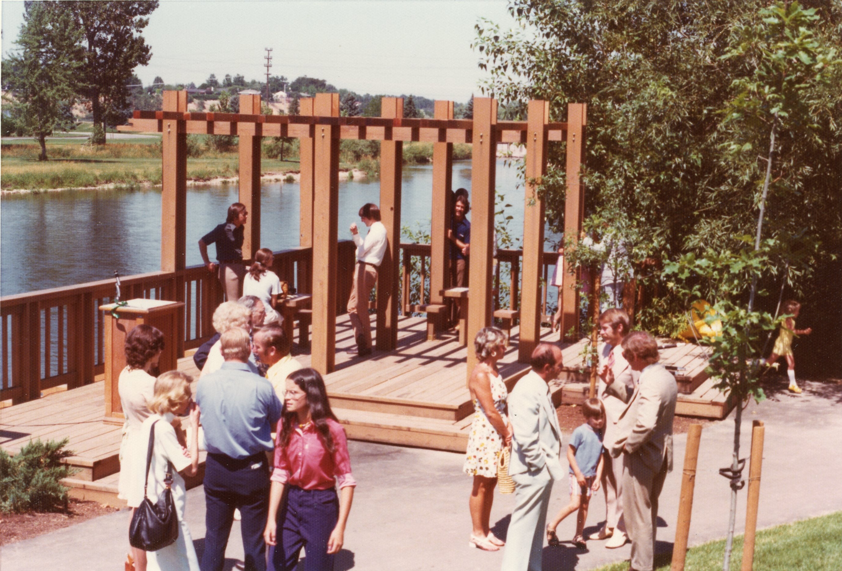
Many of these ideas came together in the completion of Shoreline Park. For all of those involved in the early days, Shoreline Park was the first major accomplishment for the Greenbelt. It stands today as a reminder of their early efforts. The park was dedicated on July 22, 1975. Ken Pursley, chairman of the Greenbelt Committee, said about the park, “It is an exciting example of what the Boise Greenbelt project is all about.” And it was—access to the river, pedestrian and bike accommodations and green space. It “paved” the way for the twenty-five miles of pathway in the city limits, and the total forty-one miles of path throughout the various jurisdictions that encompass the Greenbelt.
The Legacy of the Greenbelt
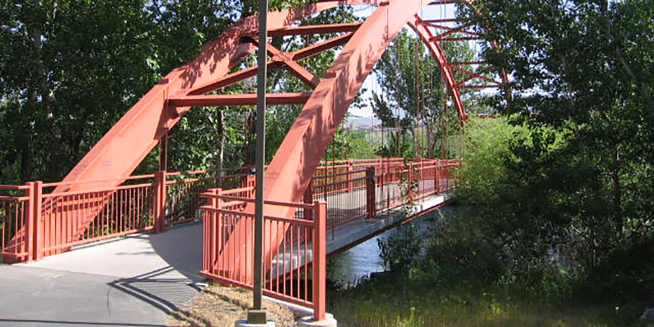
Today, the Greenbelt is a beloved community asset. It is one of many paths within the city and is an important link in the Ridge to Rivers trail system. At this fifty-year anniversary marking the creation of the Greenbelt Committee and the first comprehensive plan for the pathway, we must remember that the Greenbelt was a community effort. No one person is completely responsible for its existence and we all bear the responsibility of caring for it. Its creation occurred during the 1960s, a decade that shaped Boise into the modern city it is today. And finally, the Greenbelt was a convergence of ideas and interests, from comprehensive planning, recreation, public access, to flood control; that’s why it was so successful. No single agenda could have created what we have today. And it’s the combination of current interests—recreation, commuting, habitat restoration and others–that will carry the Greenbelt forward into the next fifty years.