Arash Modaresi Rad, Computing Ph.D. student in the Data Science emphasis, completed the Hydroinformatics Innovation Fellowship with CUAHSI in 2020. To apply, he wrote a three-page proposal of how he intended to map water bodies and how this work can benefit the scientific community. Modaresi Rad was one of three applicants accepted for this highly competitive fellowship.
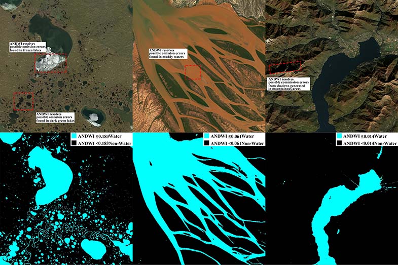
During his time at the Hydroinformatics Innovation Fellowship, Modaresi Rad proposed a novel spectral index namely Augmented Normalized Difference Water Index (ANDWI) by analyzing reflectance characteristics of water and non-water surface features in Landsat 4, 5, 7, and 8 surface reflectance imagery. He then developed an open source Google Earth engine application that allows the users to get shapefiles and surface area of water bodies every 16 days from 1984-present globally.
When asked about how this experience helped him to reach his goals in the PhD program, Moderasi Rad said, “The Hydroinformatics fellowship helped me explore a chapter of my Ph.D. thesis that was focused on monitoring land surface water bodies. This grant financially supported me throughout summer of 2020 that led to developing a novel index to delineate water bodies and an open-source app. My findings were later published in the peer reviewed journal of Environmental Modelling & Software. Then I used this research and findings to complete my comprehensive exam.”
Modaresi Rad said his favorite part of the experience was that he had freedom to pursue the research he loved and learned a great deal about writing proposals, planning research and deliverables, and developing open source software. The most inspiring part for him was “the fact that my findings and developments can be directly used by the rest of scientific community through Hydroshare and Github for other research and analysis purposes.”
Arash Modaresi Rad’s published work can be found on the Science Direct website, and the application he helped to develop can be found on Github.