The Working Group
The Wetlands SES working group at Boise State conducts interdisciplinary research to understand human-environment interactions in wetlands. We use remote sensing, spatial analysis, Bayesian and econometric statistics, and in-depth collaboration with our stakeholder partners to better map the distribution of wetlands, measure how and why they are changing, and identify “win-win” wetland management strategies for people and for nature.
Wetlands are one of the most threatened ecosystems in the world, and are an important nexus between humans and the environment. In coastal areas such as the Great Lakes, the vast majority of humans live close to or on the shoreline. Humans simultaneously “compete” with various plant and animal life for habitat, and take advantage of the abundant ecosystem services that wetland ecosystems provide. In water-scarce regions, such as the American West, humans, livestock and wildlife converge and depend upon any available mesic resource, especially during times of drought.
Rewilding with Beaver in the western U.S.
Beavers are ecosystem architects that modify their local environment by building dams, which influences the distribution, seasonality, quantity and quality of precious water, locally and downstream. On the North American continent, prior to European settlement, there were as many as 250 million beaver ponds, impounding enough water to submerge Washington, Oregon, and California. In the early 1800s in the American West, over a span of just 30 years, fur trappers brought the beaver to the brink of extinction. By the 20th century, researchers estimate that just 100,000 beavers, less than 1% of the historic beaver population, survived. The absence of beaver, along with other land use changes brought about by white settlement, led to a massive loss and deterioration of mesic ecosystems. There is a great deal of enthusiasm about the potential for beaver rewilding as a low-cost strategy for ecosystem restoration and climate adaptation, but the science of beaver rewilding is well behind its implementation on-the-ground, and the major goal of this NASA project is to use earth observations (EO), in-situ biological data, an ecological forecasting model, and deep engagement with end user partners for adaptive management of the beaver rewilding process.
COASTAL WETLANDS IN THE GREAT LAKES
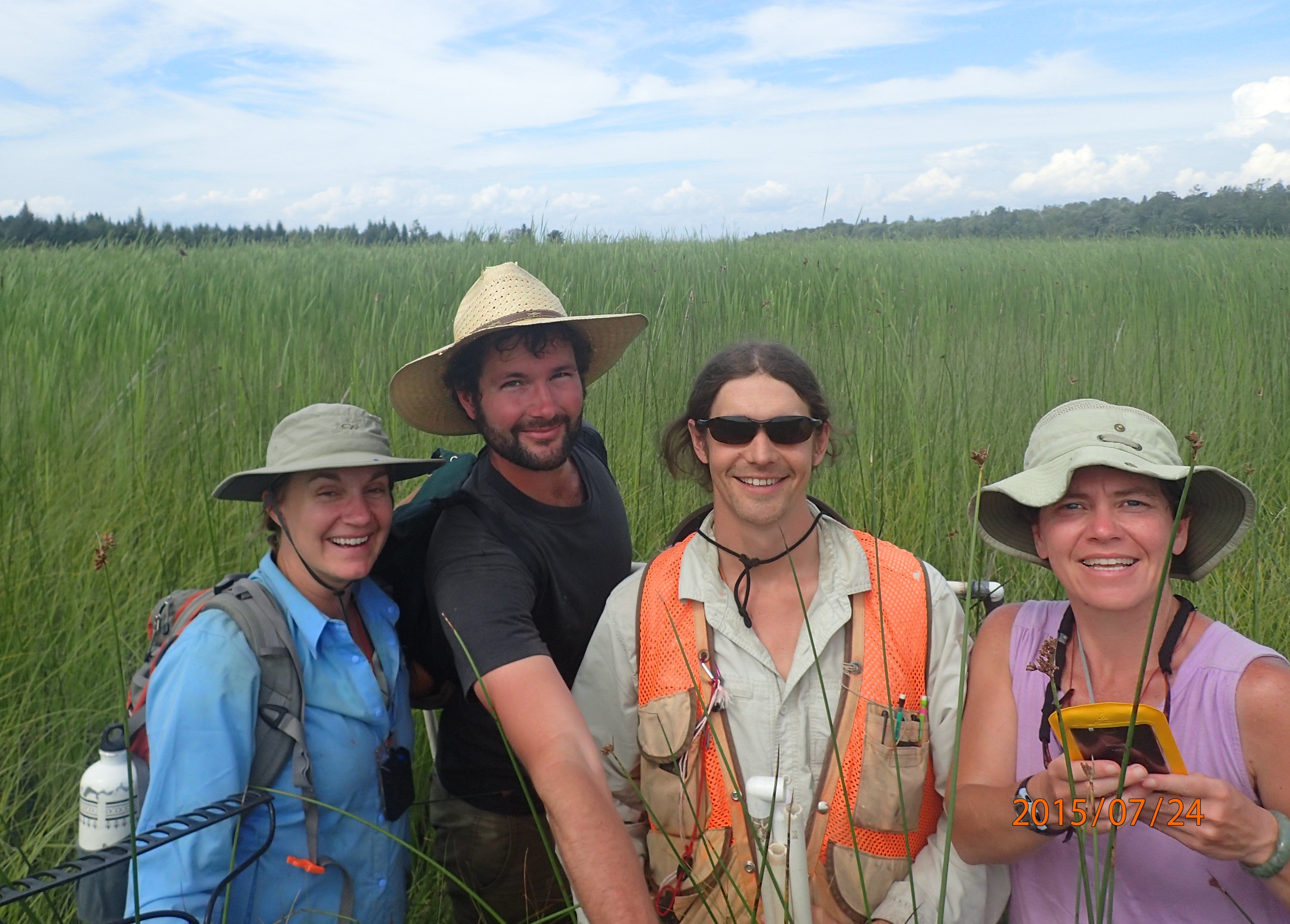
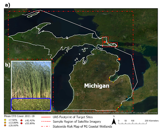
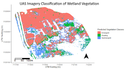
In the Great Lakes, we (led by PhD student Louis Jochems) study the invasive species, European Frogbit (EFB), which has recently invaded some coastal wetlands in Michigan. It is one of those “game changer” invasive species, with the potential to spread rapidly and lead to ecosystem regime shifts. Ecologists and managers must act urgently to prevent this spread. Our team of remote sensing experts, experimental wetland ecologists, and tribal conservation scientists work together to develop new detection and management methods. Invasive plant species commonly co-occur, and often-times, one species is obscured by the other one, making the hidden plant very difficult to detect with remote sensing. This is the case with EFB, which is a floating leaf plant that co-occurs with emergent plants such as invasive cattail and phragmites. We use cutting-edge remote sensing technology (Unpiloted Aerial Systems and optical-radar fusion), field data, and other geospatial layers to map EFB occurrence accurately and predict its spread in the Great Lakes region. Ultimately, we are working to create an interactive, decision-support tool for managers to conduct adaptive management of EFB spread in Michigan wetlands.
MESIC RESOURCES IN THE WESTERN US
WaRSHD- Water Resource mapping with Sentinel data in the High Divide
Development and climate change in the High Divide is placing stress on water resources. This region is of great importance for iconic species such as sage grouse, elk, and salmonids, and functions as a conduit between two relatively intact ecosystems: The Crown of the Continent and the Greater Yellowstone Ecoregion. All life depends on access to water, but no maps are currently available to effectively monitor water resources (surface water, wetlands, and mesic meadows) in aggregate (Figure 1).
We (led by PhD student Nick Kolarik, seek to use earth observation data to measure how these highly variable water resources are changing. There are two problems with the current available products for monitoring water resources :
- Maps are too coarse spatially to detect small, but important, water resource areas
- Maps are too coarse temporally and represent single dates or have substantial gaps between observations
The Boise State Team
Jodi Brandt, Louis Jochems, Nick Kolarik, and Anand Roopsind
Collaborators on Beaver Rewilding: Joe Wheaton and Wally MacFarlane, Utah State University, and Philip Bailey, North Arrow Research
Collaborators in the Great Lakes: Shane Lishawa and Drew Monks, Loyola University-Chicago, Jason Tallant, University of Michigan Biological Station, Eric Clark and Dani Fegan, Sault Tribe Inland Fish and Wildlife Department
Grants and Products
USDA AFRI NIFA Grant Program: “FACT: Drought decision-support platform (DDeSuP): Deriving physical drought metrics from Earth
observations for integration into ranch management and economic models.”
Michigan Department of Natural Resources MISGP Grant Program: “Statewide Risk Assessment and Adaptive Management of European Frogbit”.
Lishawa, S. C., B. D. Carson, J. S. Brandt, J. M. Tallant, N. J. Reo, D. A. Albert, A. M. Monks, J. M. Lautenbach, and E. Clark. 2017. Mechanical Harvesting Effectively Controls Young Typha spp. Invasion and Unmanned Aerial Vehicle Data Enhances Post-treatment Monitoring. Frontiers in Plant Science 8.
Funding Sources
Michigan Invasive Species Grant Program
USDA National Institute of Food and Agriculture
