Information about Flooding
Overview
What to Expect
The Boise River is dam controlled, but can flood. Every few years the Boise River experiences flows that are higher than normal. They can cause minor flooding in low elevation areas near the river. In 2017, peak flows reached 9600 cubic feet per second (1 ft3 ≈ 1 basketball). Dam managers were days away from having to release more water from the dam and flood larger areas surrounding the river. Parts of the greenbelt were washed away and some homes near the river flooded.
Worst-Case Scenario
During a worst-case scenario, major flooding would occur near the river in Boise, Garden City, Eagle, Star, and Caldwell. Some homes in low lying areas near the river would be flooded with water. Many city parks near the river, would be underwater. Debris piling up on bridge crossings will cause additional flood damage. The last flood of this magnitude on the Boise River happened in 1943. This was before the river was dam-controlled. (Source: National Weather Service)
How to prepare
- If you live, work, or recreate along the rivers in the Treasure Valley, it is important to know that it can flood.
- When flood waters cross a road or walkway, do not attempt to drive or walk through them. It only takes 6 inches of flowing water to knock you down and 12 inches to wash a vehicle away.
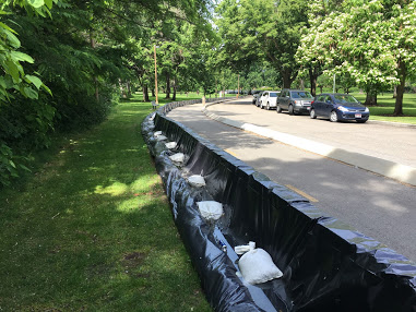
- Homeowners can prepare their homes by filling and setting up sandbags, gathering important documents, and moving items above flood levels.
- Find out if you live in a floodplain. Search your address.
Local Resources
- Sign up for the Idaho State Alert and Warning System
- Ada County: Flood Information
- National Weather Service: flood safety tips & real-time river flow information
- Sandbag pick up locations (paywall) as shared in the Idaho Statesman newspaper.
How is this hazard impacted by a changing climate?
The chance of flooding in the region could increase. Seasonal snowmelt plays a role in the river flow in the region. Hotter temperatures can trigger more events where rain falls on snow and melts it more quickly. This results in snowmelt-fed rivers reaching their peak flows earlier in the spring and can increase the chance of flooding. (Sources: NOAA – ID Climate Summary & UCS: Climate and Flooding)
Written by Carson MacPherson-Krutsky and edited by Jay Breidenbach from National Weather Service Boise