Railroad Town
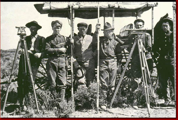
Railroads were important to the economy of towns during the late nineteenth and early twentieth centuries while having profound affect on the growth patterns of urban areas. Railroads attracted businesses and businesspersons, both of which contributed to city growth and development patterns. Railroad depots and the rails extending from them attracted or repelled various types of development, serving to influence a city’s economic center, as well as, the residential and industrial landscape. In many cases, including Boise, the railroad downtown divided the City with its considerable lines of rail, support structures, and warehouse district buildings. Contemporary maps of the Boise area depict the railroad as a substantial part of the City landscape, attracting commerce and industry while altering the composition of many nearby residential areas.

Date Drawn: 1893
Cartographer: Unknown
Publisher: Sanborn Fire Insurance Company
Collection: Sanborn Fire Insurance Company
Boise’s first connected to the railroad via a branch line from Nampa. The trains reportedly had to back into Boise along the “Stub” track toward the modest depot on the Boise Bench. Boise residents were unhappy with the location due in part to the long rough dirt road between the City and the depot that often became an impassible muddy mess.
Date Drawn: 1930
Cartographer: Unknown
Publisher: Boise Chamber of Commerce
Collection: Boise State University Library
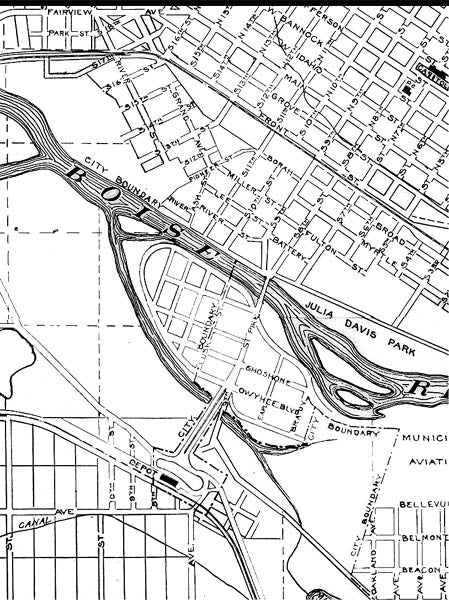
Boise finally connected to the mainline of the Union Pacific with the completion of the present day depot on the Boise Bench in 1925. The new depot inspired development south of the Boise River as well as the construction of Capital Boulevard.
Date Drawn: c.1925
Cartographer: Unknown
Publisher: Unknown
Collection: Boise City Archives
This map depicts the plans for the Boise Bench Depot built in 1925. This magnificent structure served primarily as a passenger depot while the location downtown continued as a freight depot. Land between the bench depot and downtown developed into a city gateway.
Date Drawn: 1882
Cartographer: Frank A. Gray
Publisher: Unknown
Collection: “An Atlas of Idaho Territory 1863-1890” – Merle W. Wells
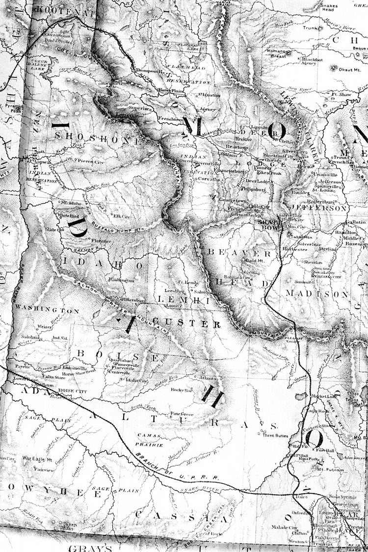
Frank Gray portrayed known railroad lines when possible but had to guess on the location of future locations. With this map, Gray incorrectly depicts the Oregon Short Line as passing through the City of Boise. Much to the chagrin of many Boise residents, the rail line bypassed the city choosing instead a path further south five years after the completion of this map.
Date Drawn: 1907
Cartographer: Unknown
Publisher: Oregon Short Line Railroad
Collection: Boise City Archives
The downtown railroad district had a tremendous impact on the City of Boise. The new industrial businesses and ever-increasing rail lines cut off once prominent residential areas from the rest of the City. As a result, neighborhoods near the tracks steadily declined helping to create a dilapidated area attractive only to the most destitute of citizens.
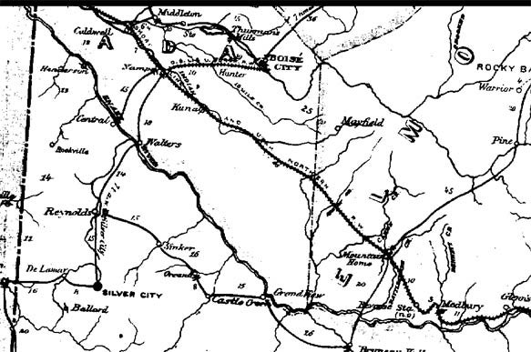
Date Drawn: 1884
Cartographer: C. Roeser Jr.
Publisher: Post Office Department, United States of America
Collection: “Maps of Early Idaho” – R. N. Preston
This map accurately depicts the mainline of the railroad through Kuna, Nampa, and Caldwell as well as the branch line between Nampa and Boise.
Date Drawn: c.1893
Cartographer: Unknown
Publisher: Unknown
Collection: Boise City Archives
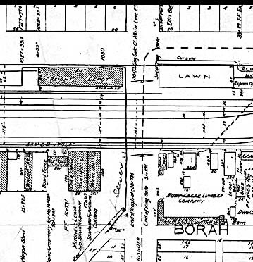
This map shows the railroad located in the eastern part of downtown Boise in the late nineteenth century. Noticeable is the prominent warehouse district that had an altering affect on the surrounding residential, commercial, and industrial areas.
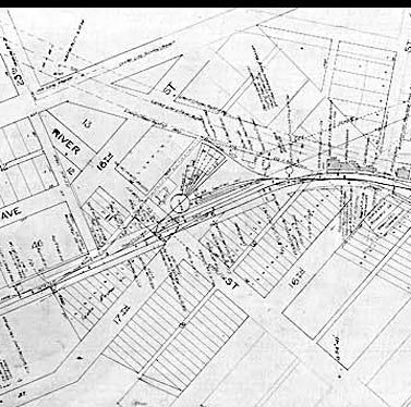
Date Drawn: c.1893
Cartographer: Unknown
Publisher: Unknown
Collection: Boise City Archives
This maps shows the railroad located in the western half of downtown Boise in the late nineteenth century. Notice the amount of rail lines near the depot south of Front St. Rail cars were turned around and stored at the roundtable located near the corner of Seventeenth and River Streets.
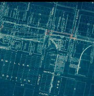
Date Drawn: c.1893
Cartographer: Unknown
Publisher: Unknown
Collection: Boise City Archives
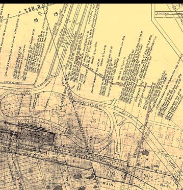
This detailed map illustrates the busy railroad district near downtown Boise around the turn of the century. The passenger depot, near Tenth and Front Streets, was a spectacular improvement over its modest predecessor on the Boise Bench. Railroad districts during this time often attracted hotels and saloons and in Boise, these establishments were located primarily north of the depot area.
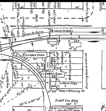
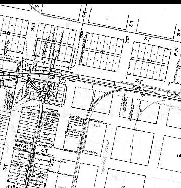
Date Drawn: c.1893
Cartographer: Unknown
Publisher: Unknown
Collection: Boise City Archives
As shown in this map, trains loaded and unloaded goods via alleyways between the buildings permitting easy access to loading docks in the warehouse district.