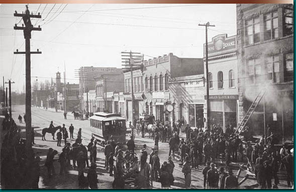
The relationship between the city shape and light rail in the form of electric trolleys is evident in maps of Boise between 1891 and 1928. Many residential areas of the time, not so coincidently, followed the rail lines throughout the City. Sometimes the trolley extended into preexisting neighborhoods or, just as commonly, residential areas followed the trolley into more remote developing suburbs. Rural inhabitants and smaller valley communities also benefited as the trolley allowed them to live outside the city limits and still occasionally experience the advantages of city life. The following maps demonstrate the intricate relationship between the electric trolley and the City of Boise. The trolley seemed to reach every part of town and much of the Boise Valley as seemingly few communities developed without electric streetcar influence during this time. Its success as a profit maker is negligible and as mass transportation, short-lived, but its influence in helping to shape Boise around the turn of the century is certain.
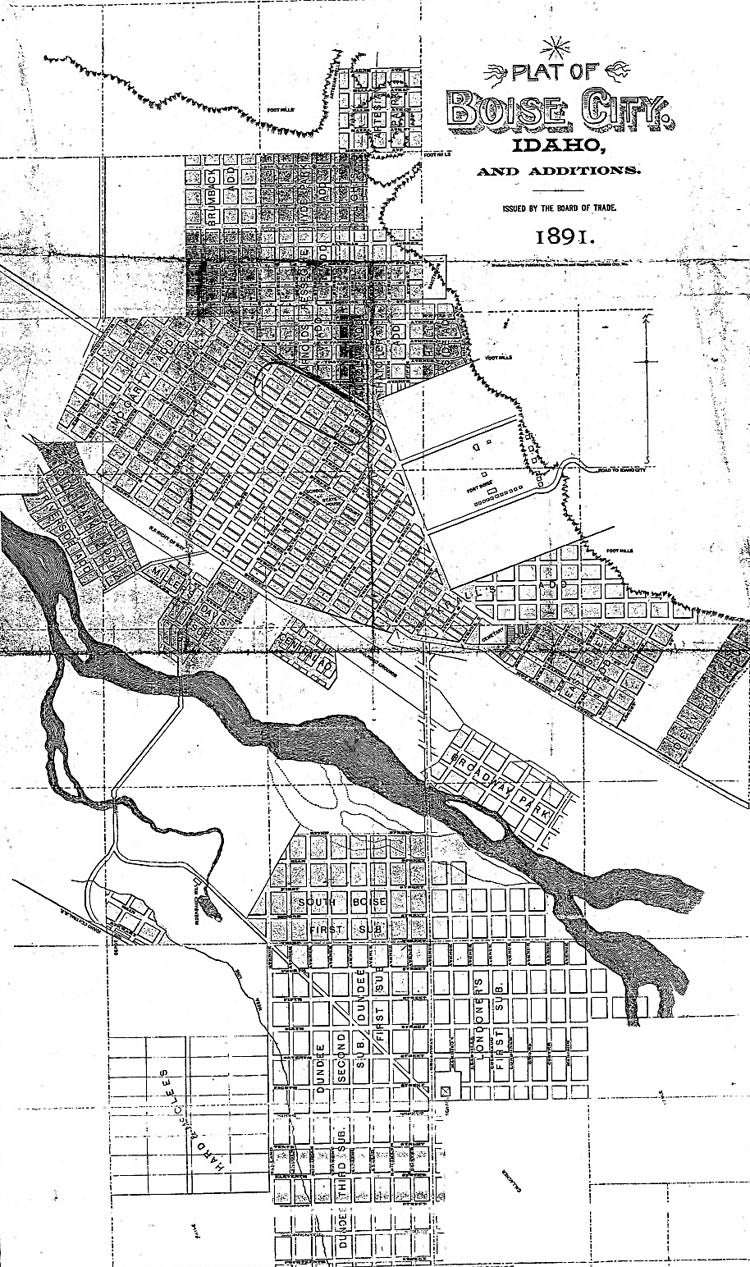
Date Drawn: 1891
Cartographer: Issued by the Board of Trade
Publisher: Hudson-Kimberly Publishing Co., Printers and Engravers
Collection: Idaho State Library and Archives
Trolleys allowed the citizens in all parts of the city to commute quickly and easily throughout town. At its height, the streetcar system traveled through a number of streets in the primarily residential North End and transported residents to and from the far reaches of South Boise.
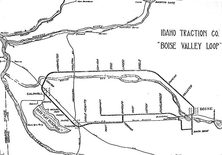
Date Drawn: Early Twentieth Century
Cartographer: Unknown
Collection: Idaho State Historical Society
Publisher: Unknown
The Boise Valley Loop, completed in 1912, connected the residents of several towns and small communities throughout the valley. Whether traveling for business or pleasure, a person could take a trip to anywhere from anywhere on the circuit in thirty to ninety minutes.
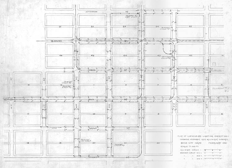
Date Drawn: February 1913
Cartographer: Unknown
Publisher: Unknown
Collection: Boise City Archives
This map depicts the heart of downtown Boise and the many arteries of the Boise electric trolley system. The Front Street line extended west across the river, following the Main Street east took travelers to the Natatorium, while 8th and 10th Streets extended deep into the North End.
Date Drawn: 1917
Cartographer: S. Leigh Savidge
Publisher: Intermountain Map Company
Collection: Boise State University Collection
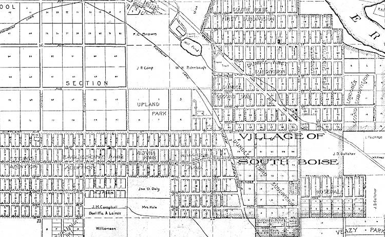
The Village of South Boise existed as a separate community for a number of years before its incorporation into the City of Boise. Both the electric trolley system and the development of irrigation on the Boise Bench contributed to its growth and success. The trolley traveled south on Broadway, west on Chamberlain and 11th, then north on Roosevelt.
Date Drawn: June 6, 1913
Cartographer: Unknown
Publisher: Unknown
Collection: Boise City Archives
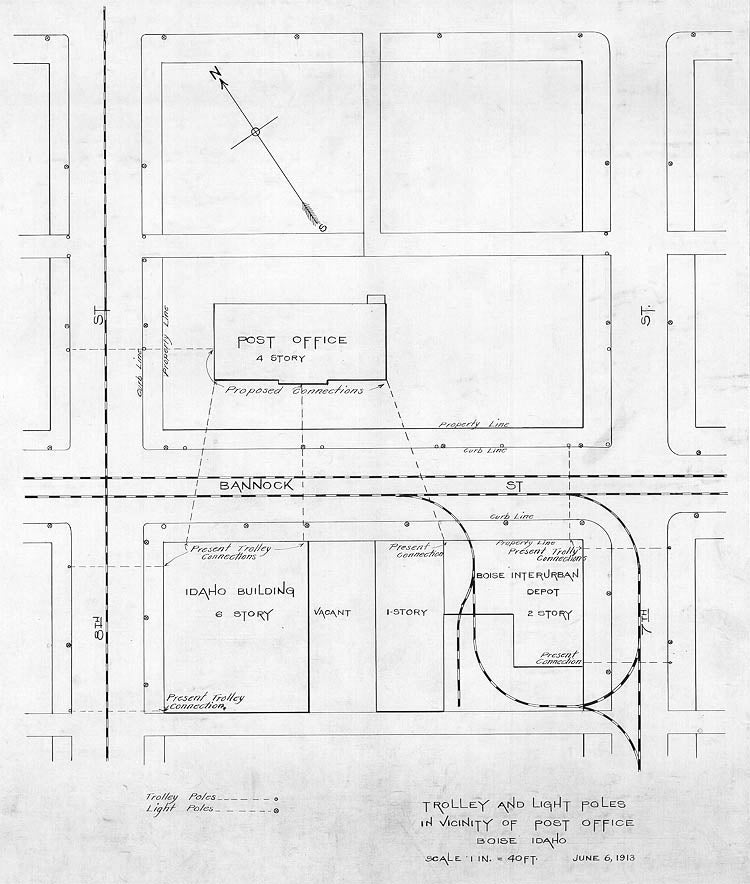
Three trolley companies merged in 1912 to form the Idaho Traction Company. The depot, located on 7th and Bannock, allowed the trolleys to travel through the building and out an alley behind the building. Idaho power later took control of the company and located offices on the second floor of the depot.