Remote Sensing of Snow Water Equivalent
Estimates of the Snow Water Equivalent (SWE) – the volume of fresh water that a given snow-covered area represents – are required for water resource management, hydro-power, and flood forecasting. Over a billion people worldwide depend on snow-melt for water supply. Increases in temperature and precipitation will significantly alter the distribution of snow greatly complicating prediction of this already poorly understood but critical water resource.
Although snow covered area (SCA) can currently be accurately estimated from space using optical techniques, SCA only gives information about where snow is, but not how much water is stored (SWE). Estimating SWE using remote sensing techniques remains problematic, as manual ground-truth measurements in typically highly variable snow conditions are time-consuming. Much of the annual runoff in the Western U.S. originates as snow in the high elevations, where measurements are difficult and sparse, and spatial variability is large. Estimates of annual SWE are also crucial in the polar regions, as the melt from both the alpine glaciers and ice sheets is a major factor in sea level rise.
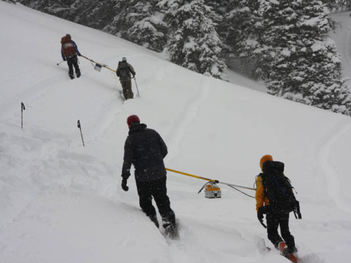
We are using portable ground-based radar observations to understand spatial variability of snow and its effect on remote sensing of SWE. We are using data from Idaho, Colorado, Alaska, and Greenland to test and improve inversion algorithms for estimating snow properties from ground, airborne, and spaceborne active radar.
Despite the promise of microwave radar for retrieving SWE, practical application of space-borne microwave radar remains difficult due to: 1) sub-pixel heterogeneity of snow properties, and 2) sensitivity to snow grain size, both of which have a large but poorly understood effect on radar backscatter, and are both difficult to accurately measure and model. We are developing strategies for combining microwave remote sensing, high resolution ground-based observations, and modeling for estimating the spatial distribution of SWE.
Researchers
H.P. Marshall, John Bradford, Kasper Van Wijk, Alejandro Flores, Jim McNamara, Achim Heilig, Scott Havens, Andrew Hedrick, Andrew Peterson, Jason Jennings, Jake Robertson, Katelyn Watson, Austin Hopkins
Funding
NASA EPSCoR (1/2011-12/13), NASA New Investigator Program (7/2010-6/13)