River City
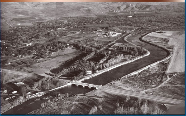
From the beginning, the founders of the City of Boise had to consider the nearby Boise River when planning the future capital city. Organizers of Boise designed the town site so that main street ran parallel, though not too close, to the erratic waterway. They wanted the city to be far enough away to avoid any flooding, yet close enough to take advantage of the abundant water supply. As years passed, the unpredictability of the water’s path and level kept development to a minimum alongside the river. For many decades, locals built levees on each side of the river, slowly narrowing and straightening the stream. This allowed development nearer the river though occasional flooding still kept serious growth to a minimum. Finally, in 1955, the construction of Lucky Peak Dam upstream gave Boise citizens the confidence to invest in significant development and urban expansion moved toward the riverbanks.
Early settlers considered land nearest the river suitable primarily for farming. Floods, such as the one in 1876, did little or no damage to the urban area but swamped many farms near the river and damaged bridges.
Residential land use in the flood plain had increased by 1891 though agriculture still dominated the area. Warehouses and utilities occupied some of the land between the river and the city while residential districts such as the Central Addition and South Boise braved the occasional high river waters.
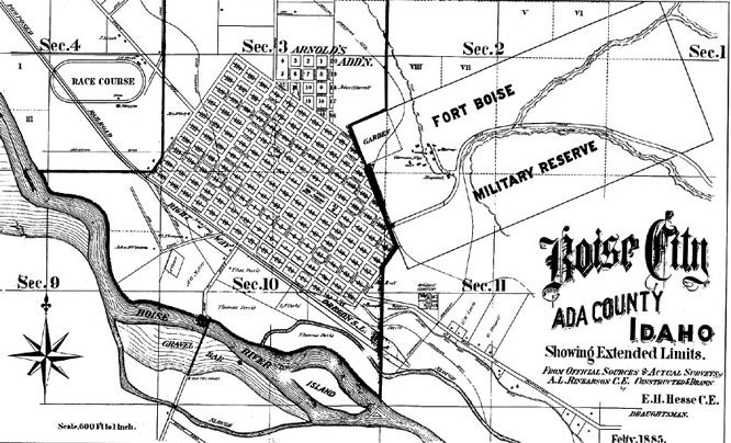
The Boise River we know today looked much different one hundred years ago. This map shows the braided shape path once common to the river.
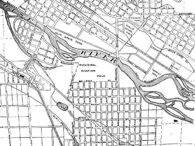
By the 1930s, Boise still had little residential development near the river constructing instead parks and the city’s first airport along the water’s edge.
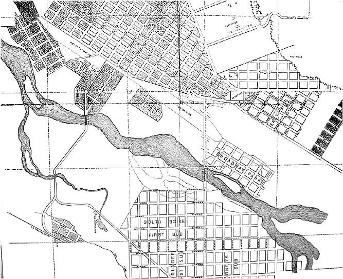
Title: Detail from “Map of Boise City and Vicinity Showing Additions and Subdivisions, 1938.”
Date Drawn: 1938
Cartographer: Unknown
Publisher: Idaho Blueprint and Supply Company
Collection: Boise State University Albertsons Library
Levees constructed between Broadway Avenue and 9th Street permitted increased development west of the Broadway Bridge.
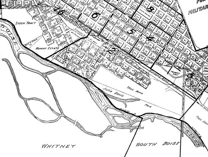
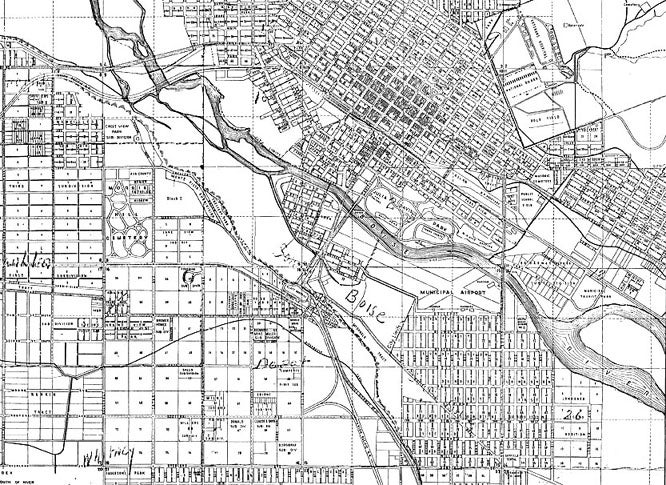
Title: Detail from “Map of Boise City and Vicinity Showing Additions and Subdivisions, 1945.”
Date Drawn: 1945
Cartographer: Unknown
Publisher: Idaho Blueprint and Supply Company
Collection: Boise State University Albertsons Library
The founding of Boise Junior College indicated confidence in the stability of riverside development. A flood in 1943 prompted many citizens to demand a solution so that future flooding would not damage homes not protected by the downtown levees.
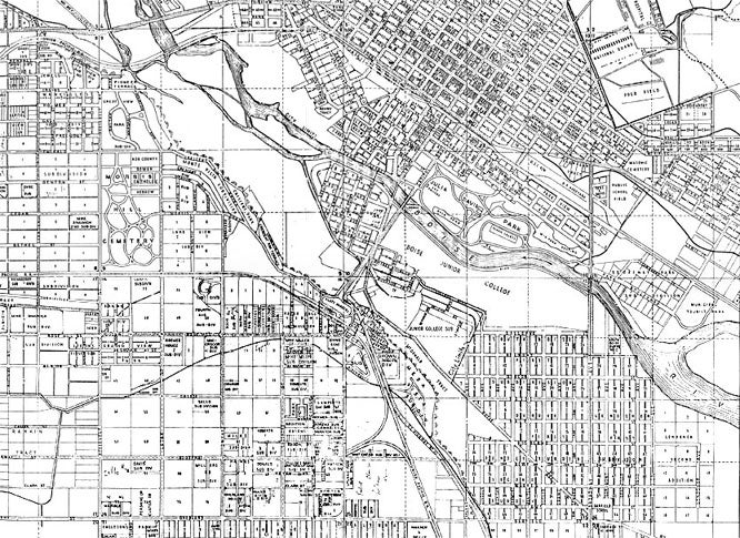
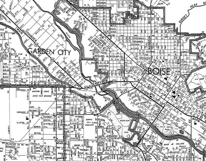
Title: Detail from “Boise City Map, 1956.”
Date Drawn: 1956
Cartographer: Unknown
Publisher: U. S. Forest Service
Collection: Boise State University Albertsons Library
The construction of Lucky Peak Dam allowed Boise residents to feel secure in developing land near the river. More levees too helped to shape the river into a narrower, straighter waterway.
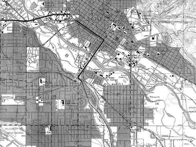
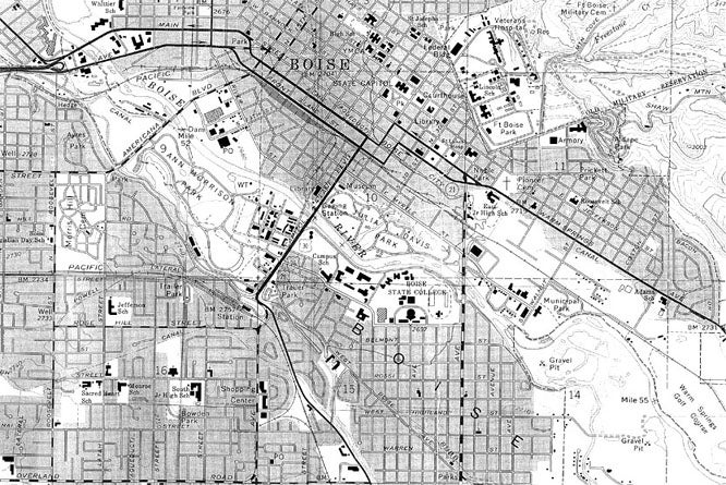
Title: Detail from “Boise City Map, 1964.”
Date Drawn: 1964
Cartographer: Unknown
Publisher: Boise City Chamber of Commerce
Collection: Boise State University Albertsons Library
By the 1960’s, land near the river became much more valuable to Boise citizens. The desire to take advantage of riverside land before industrial, commercial, and residential developers claimed it resulted in the construction of Boise River Greenbelt Park. The plan called for the park to travel alongside the river through Boise, connecting other larger parks.
Title: Detail from “Boise City Map, 1976.”
Date Drawn: 1976
Cartographer: Unknown
Publisher: U. S. Forest Service
Collection: Boise State University Albertsons Library
Urban development claimed most of the land next the river by the middle of the 1970’s. Existing parks and the construction of Ann Morrison Park created a buffer between the river and some urban development.