Real-time conditions and historical data for meteorological, stream-flow, and soil measurement stations for the dry creek experimental watershed (DCEW) can be accessed via the links below the map.
Click here for DCEW interactive map view
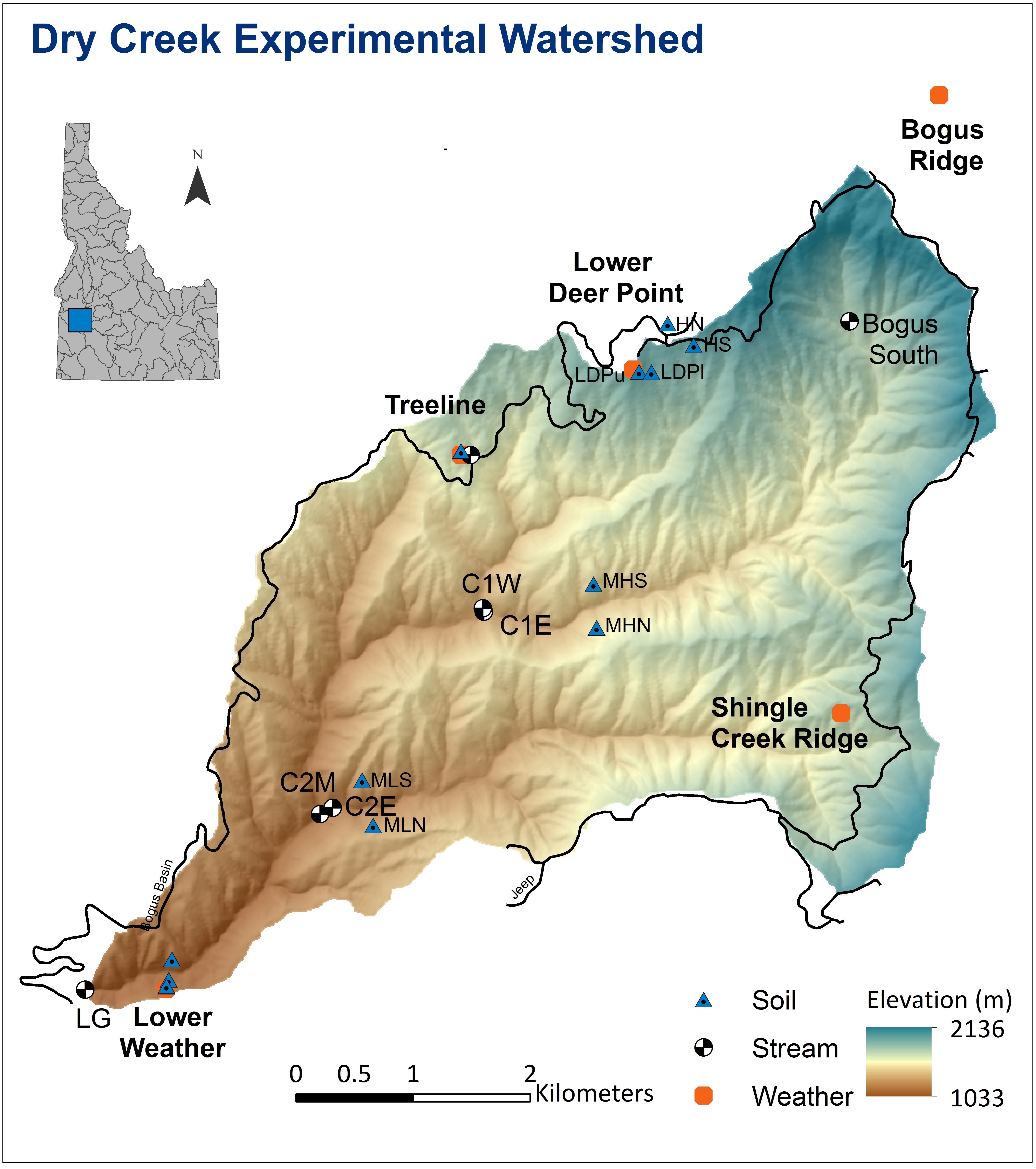
DCEW Links
Telemetered Data:
Current Conditions
Meteorological Stations
- Bogus Ridge Weather (BRW)
- Lower Deer Point (LDP)
- Shingle Creek Ridge (SCR)
- Treeline (TL)
- Lower Weather (LW)
Streamflow Stations
- Bogus South Gauge (BSG)
- Lower Gauge (LG)
Soil Measurement Stations
Non-Telemetered Data: Download
Streamflow Stations
Soil Measurement Stations
- High N-facing (HN)
- High S-facing (HS)
- Mid High N-facing (MHN)
- Mid High S-facing (MHS)
- Mid Low N-facing (MLN)
- Mid Low S-facing (MLS)
- Low N-facing (LN)
- Low S-facing (LS)
- BRW Hillslope Soil Pits
- LDP Upper & Lower Soil Pits (LDPup, LDPlp)
- TL Transect (North and South)