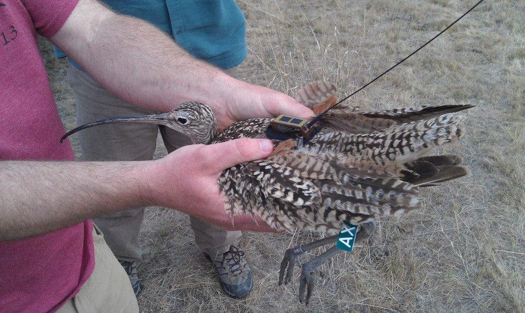
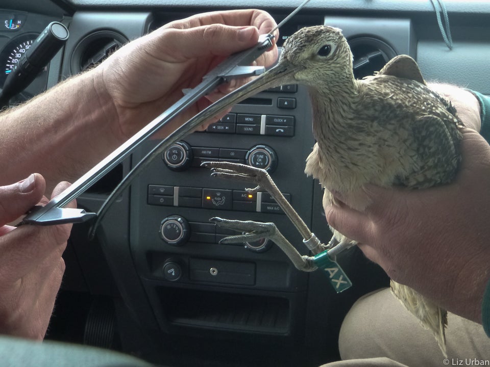
During the week of May 6th we were able to attach 3 satellite transmitters to Long-billed Curlews breeding in the Area of Critical Environmental Concern (ACEC) southwest of Emmett, ID.
Here are some photos of the trapping and ‘transmittering’ process:
To see some more photos of the capture process, check out the Idaho Statesman’s photo album.
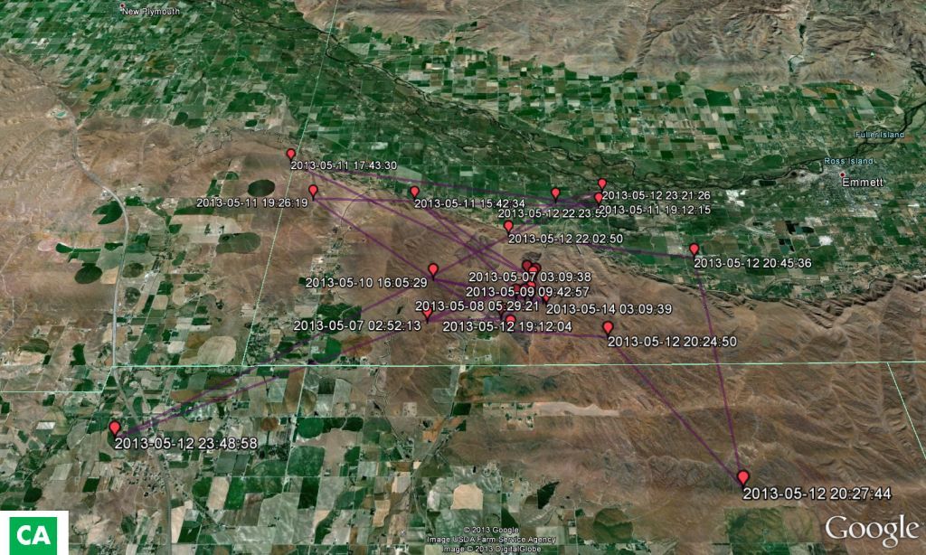
After a week of waiting, we got our first batch of data points from the satellite! Here are two examples of the results we are seeing so far (Points displayed are those with 250m accuracy or more). These maps show the movement of two birds in our study area. These two happen to be a pair, thus the cluster of points in a similar area (around their nest).
We were interested to see that both birds seem to travel long distances to forage in agricultural lands near the ACEC. Also interesting is that many of the places they travel to forage are similar, although they are not likely to be traveling together since one bird must stay to incubate and protect the nest at all times.
It’s also interesting to note that bird “CA” is the male of the pair and is much more mobile than the female. This makes sense since the female is busy incubating during most of the day.
Right now we are calling birds after their green flag letters, but stay tuned for naming updates!
Look for more updates on bird movement soon!